Dry weekend
Upper level ridging will temporarily return to the north central U.S. this weekend, which will bring in seasonally warm temperatures by Sunday and keep us dry. Highs on Saturday will range from the upper 60's in the eastern sixth of the state and lower to mid 70's elsewhere. Temperatures should exceed 70°F statewide on Sunday and may approach 80°F along the Kansas border in south central and southeastern Nebraska. No precipitation is expected through Monday.
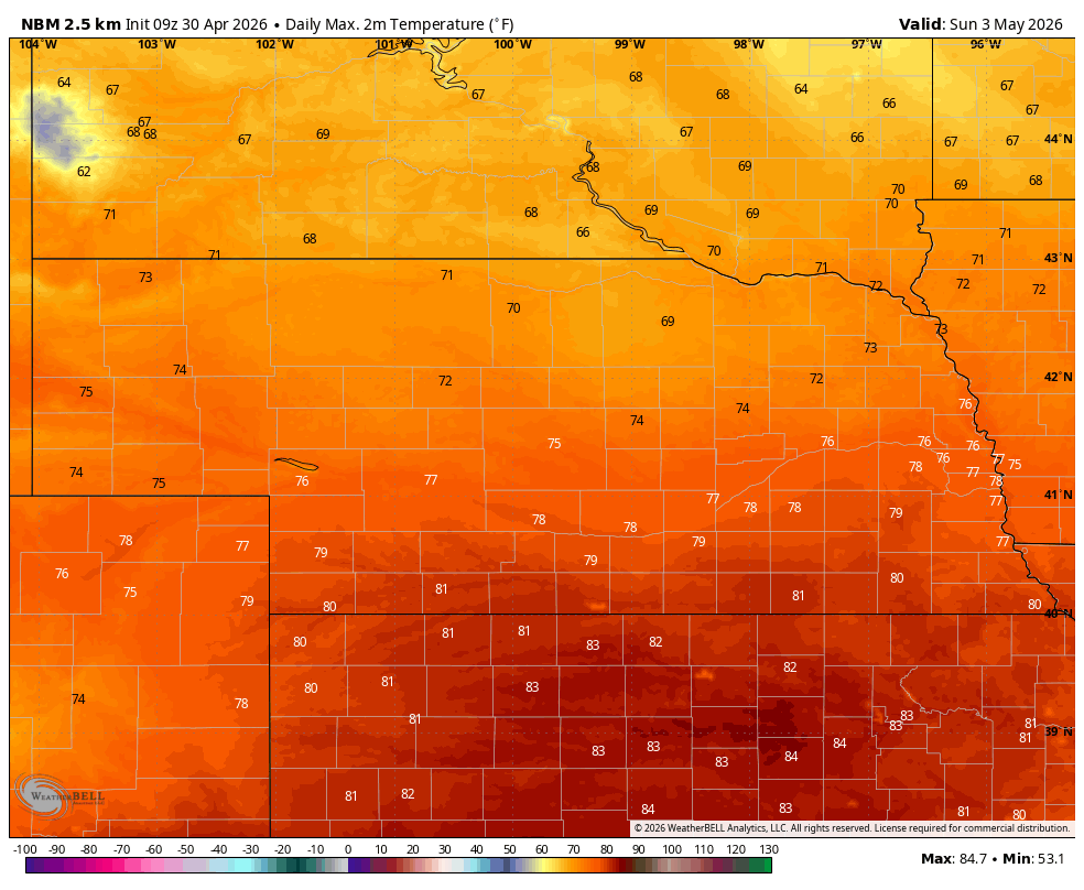
Figure 1. Projected high temperatures on Sunday according to the National Blend of Models
Cooling off
By Monday a deep trough will be moving into the Great Lakes region and a surface cold front will be moving through the state during the day Monday. The coolest air will be somewhat behind the front, so high temperatures should still get into the upper 60's to mid 70's on Monday afternoon. Winds will likely be a bit gusty after the frontal passage and fire danger will be elevated in the Panhandle and the Sand Hills. A scattered shower can't be ruled out on Monday but low-level moisture will likely be too lacking to produce anything meaningful. Temperatures will be cooler on Tuesday with highs back in the upper 50's to mid 60's.
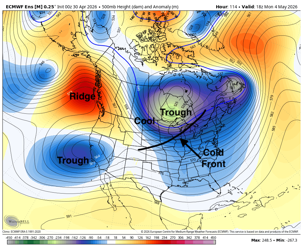
Figure 2. Projected 500-mb height pattern next Monday afternoon
Rain chances
Another cold front will move through the state later Tuesday. Moisture does appear that it will be more readily available ahead of this system and showers/thunderstorms will be possible on Tuesday afternoon and evening. Significant precipitation is not likely but the ensembles do show a good chance of picking up between a tenth and quarter of an inch. The WPC is less bullish on moisture and leaves the state dry during this period.
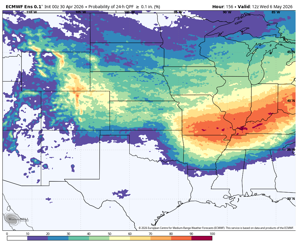
Figure 3. Probability of a tenth of an inch on Tuesday into early Wednesday
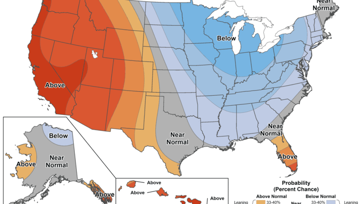
Dry and cool start to May
The first ten days of May are likely to be drier than average across a large portion of the Heartland. This will be good news for farmers in eastern Nebraska into Illinois that need some drier weather to resume planting but is not good news for the drought in the western two-thirds of the state. There may be another chance of rain/storms late next week but all in all, there is a very low probability of farmers being sidelined more than a day by rain in the next 10 days, possibly longer.
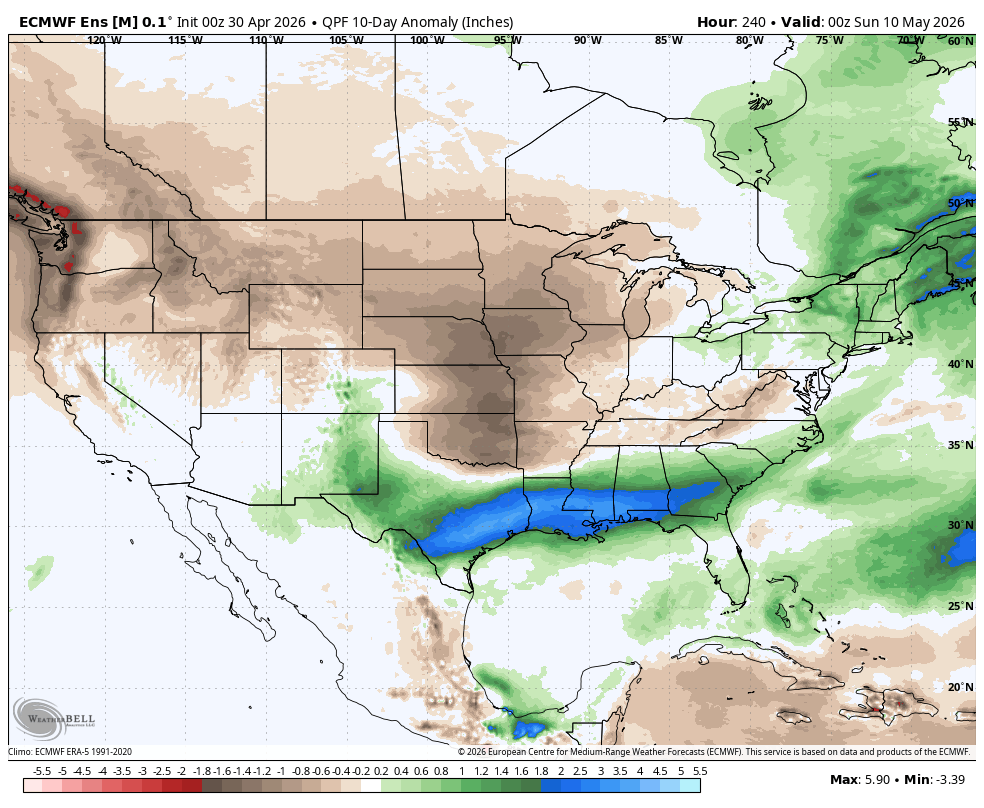
Figure 4. Projected precipitation anomalies in the first 10 days of May
With troughing being dominant over the eastern half of the country most of next week, our area will be receiving northwest flow and seasonally cool temperatures for much of next week after Monday. Highs may struggle to get out of the 50's for northern and eastern sections on Wednesday and frost may be possible in the northern part of the state on Thursday morning. Temperatures should rebound to closer to seasonal averages in the mid to upper 60's later in the week.
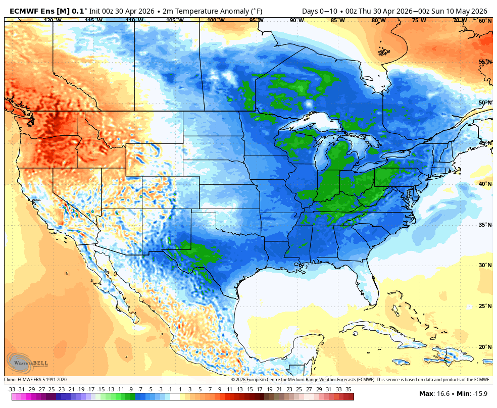
Figure 5. Projected temperature anomalies in the first 10 days of May


