Warm Memorial Day
Temperatures will start to warm back to seasonal levels on Saturday and back to above average temperatures by Sunday afternoon statewide as upper level ridging builds across the north central U.S.
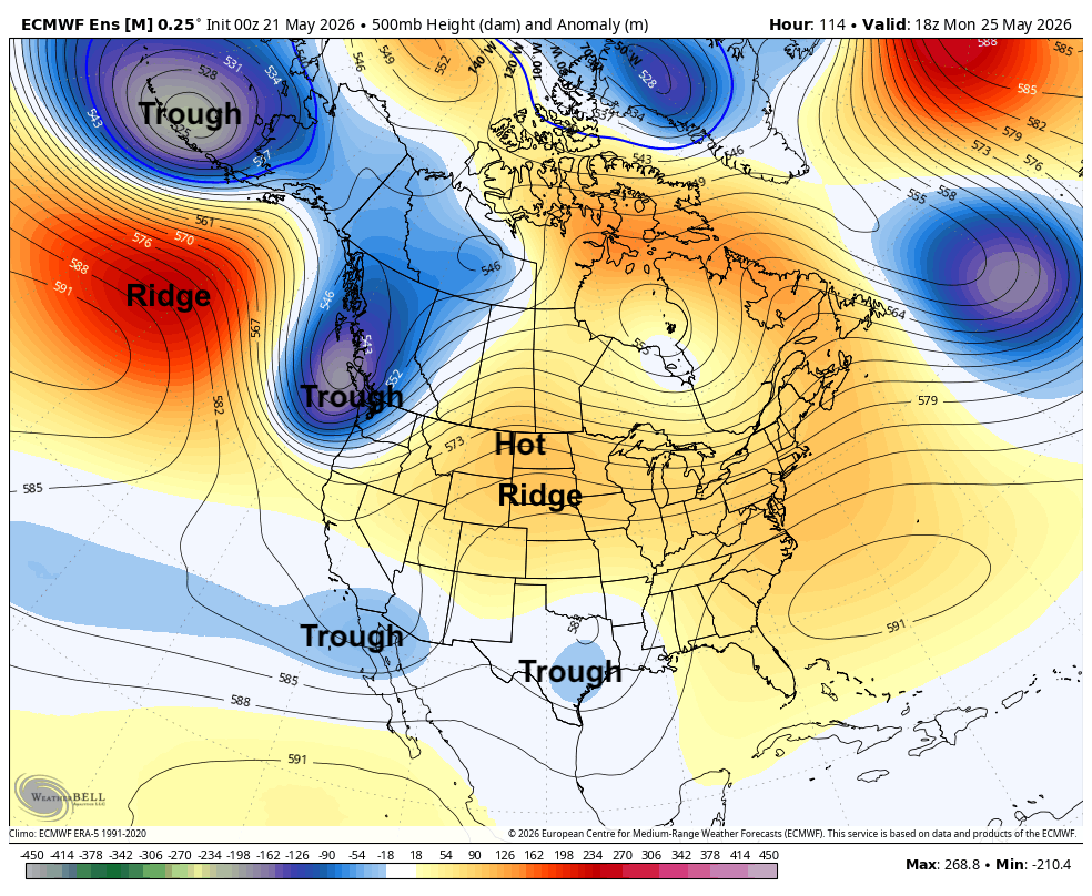
Figure 1. 500-mb height anomalies on Monday afternoon
There will be a slight chance of storms Saturday in southwest Nebraska and a small chance of showers/storms on Monday across central and eastern sections of the state as a weak shortwave sneaks into the state under the developing ridge. In general, outdoor activities should be mostly good to go on Memorial Day. Temperatures also should be warm (80's) statewide with a chance of cracking 90°F between Chadron and Valentine.
Rain chances increase
Tuesday looks seasonally warm in the 80's and mostly dry. Precipitation chances increase as we head into Wednesday and Thursday as a slow moving trough moves into the south central U.S. There is still some uncertainty as to how quickly the trough will move into the central section of the U.S. and to how much moisture will be drawn back into Nebraska.
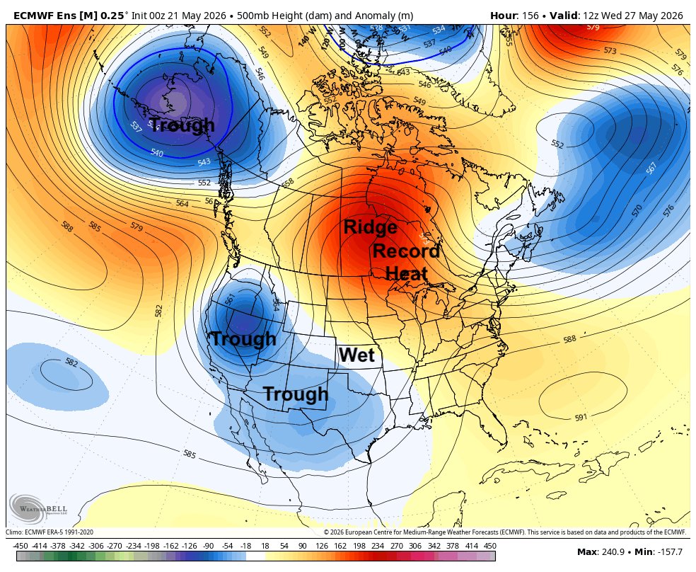
Figure 2. 500-mb height anomalies on Wednesday morning
But there is potential for decent moisture starting in western Nebraska on Wednesday into Thursday and sliding into the eastern portion of the state later in the week. The ECMWF ensemble does show average to slightly above average precipitation for much of Nebraska with drier conditions to our northeast and wetter conditions to our southeast. If that ridge is a but further southwest, then it is more likely that eastern and north central sections receive less moisture. It is also possible that there are pockets of significant precipitation, particularly along and south of the Platte. This also should be a favorable setup for useful moisture getting into the Panhandle.
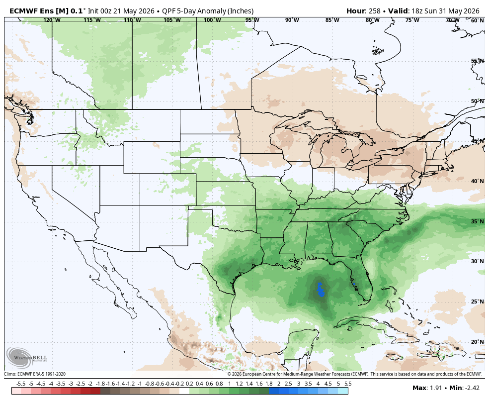
Figure 3. ECMWF ensemble's 5-day precipitation anomalies through late Saturday
Warm temperatures
Temperatures are likely to remain above average through the week, though afternoon temperatures may be held down in the second half of the week in areas with more cloud cover and precipitation. But highs in the 70's and 80's should be common with warmer overnight lows than what we have been experiencing recently. Temperatures are likely to remain on the warm side into the first few days of June.
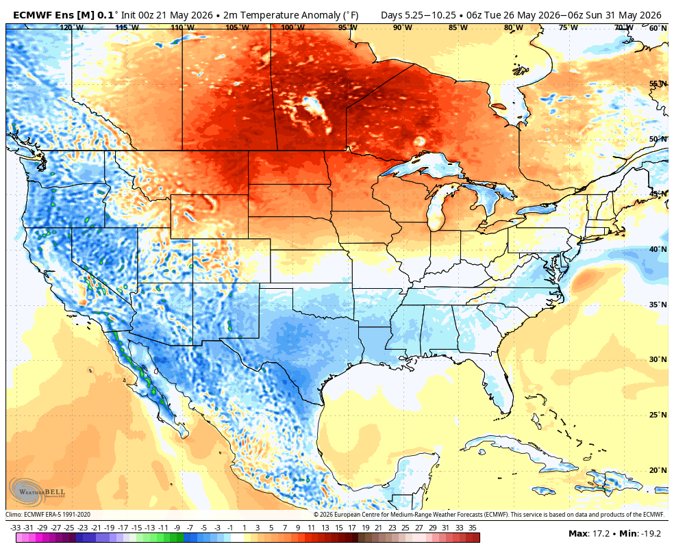
Figure 4. Projected temperature anomalies next Tuesday-Sunday


