Unseasonably warm and fire danger
A current look at upper air analysis shows that we have a strong ridge of high pressure in the middle to upper portion of the atmosphere over the central portion of North America and a stronger trough coming into the western United States. Between the higher pressure further east and lower pressure further west, we are starting to get a bit more of a pressure gradient, which means we are starting to get a bit more wind from the south here in this region of the country. Red flag warnings are in place across much of west central Nebraska tomorrow. With that large ridge in place, we have a lot of warm air aloft that's being mixed down toward the surface. We currently have temperatures well into the 80s, pretty much everywhere with some places in central and eastern Nebraska cracking 90°F.
Temperatures should back off just a little bit across portions of western Nebraska tomorrow. We will probably see a little more cloud cover so that should hold temperatures down closer to the mid to upper 70s, maybe the lower 80s. Everywhere east of Ogallala will remain quite warm tomorrow. High temperatures are expected to be at least in the mid 80s and I would anticipate at least portions of central and eastern Nebraska flirting with or even exceeding 90 degrees tomorrow afternoon.
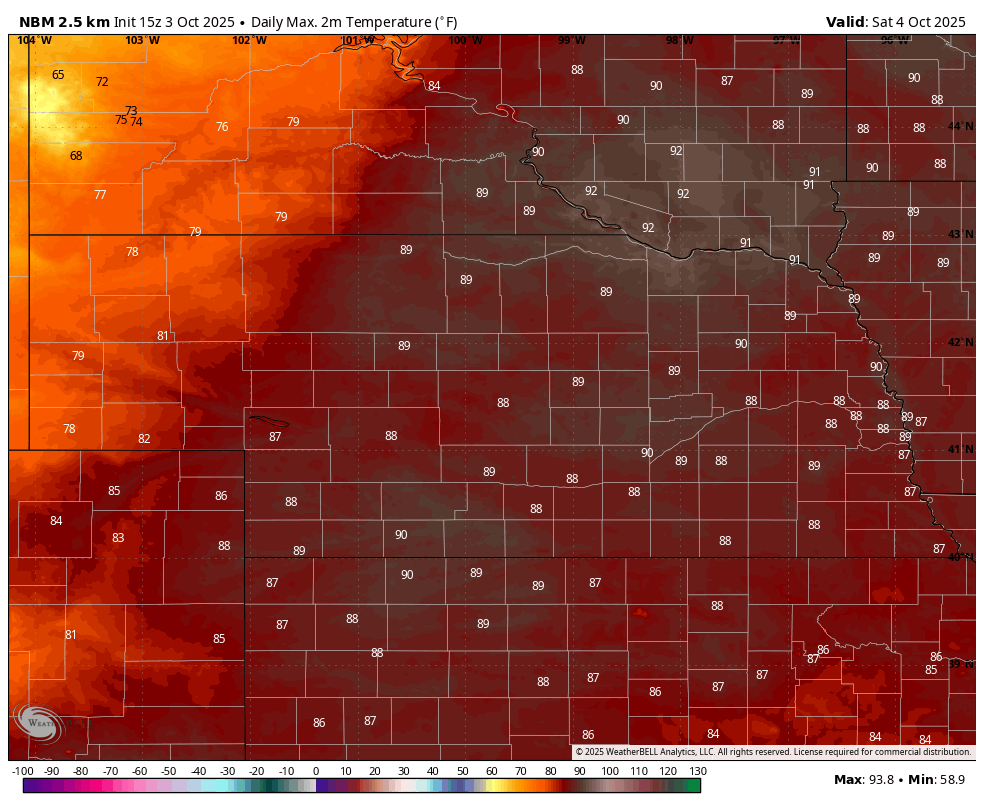
Figure 1. Projected high temperatures tomorrow
Rain chances
The trough that is currently in the western U.S. will move into the Northern Plains over the next few days and help drag a cold front at the surface through the region. Atmospheric forcing will be sufficient to produce showers and storms across the High Plains tomorrow night into Sunday morning, with some areas of the Panhandle possibly picking up over half an inch of moisture. The front is likely to come through central and northeast sections of the state dry on Sunday, but temperatures will be 5-10°F cooler than tomorrow. Additional forcing in the 850-700 mb layer will allow for showers and thunderstorms to develop across the southeast quadrant of the state. Current indications are that rainfall may be heavy in the far southeast section with over 2" possible
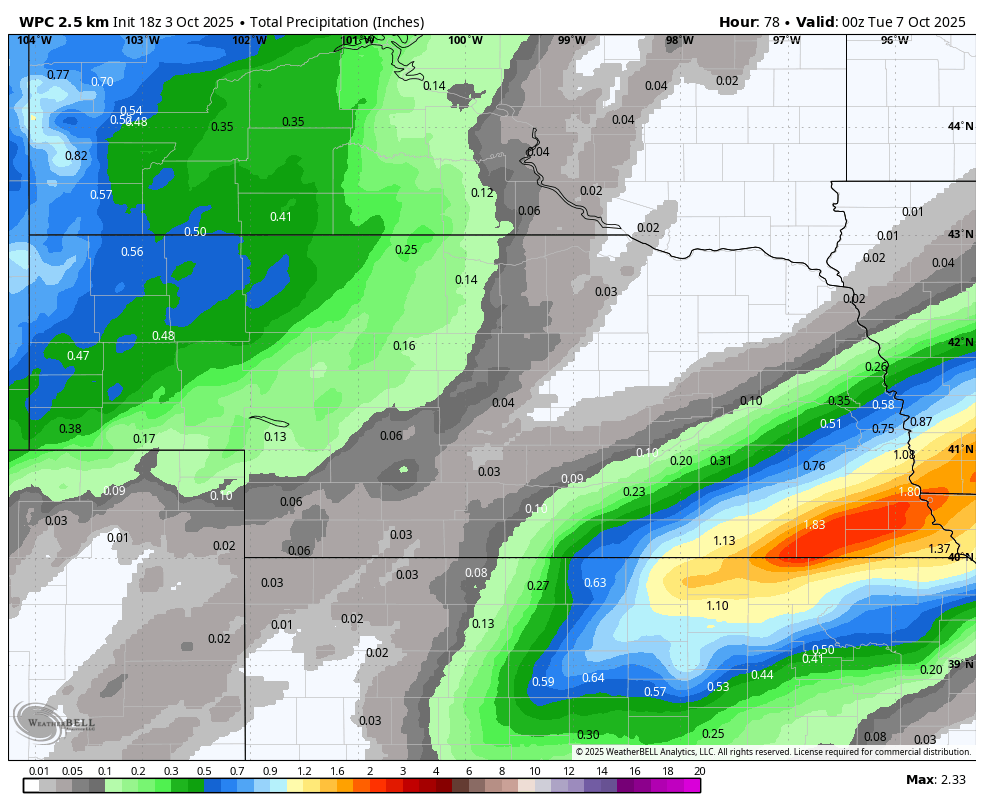
Figure 2. WPC projected rainfall totals through Monday evening
Warm weather prevails
Temperatures will be on the cooler side on Monday with cloud cover and/or precipitation (southeast) and highs likely will be in the 50's and low 60's statewide. Skies should clear on Monday night in the northern half of the state and temperatures will drop to the coolest levels most of us has seen since early September with mid to upper 30's in the Panhandle and 40's to lower 50's elsewhere. Temperatures likely will remain around seasonal averages Tuesday and will start a climb back to above average on Wednesday. With ridging being prominent across the central U.S., temperatures are likely to remain warm through at least mid-month. There will be a chance for showers again later in the week across the eastern half of Nebraska. Otherwise it likely will be dry and warm for much of the next 7-10 days after Tuesday morning. Good harvest window again it appears.


