Hot weekend
Current analysis of the 500-mb map shows a weak ridge in the southwestern U.S., a deeper trough east of Hudson Bay, and mostly zonal (west-east) flow across the lower 48. Over the next few days, ridging will be building back into the central U.S. and the heat will be on. Temperatures will climb into the 90's statewide tomorrow and likely peak Saturday, with parts of southwestern Nebraska likely getting into the lower 100's. Minimum temperatures will also be quite warm with 60's west and 70's central and east.
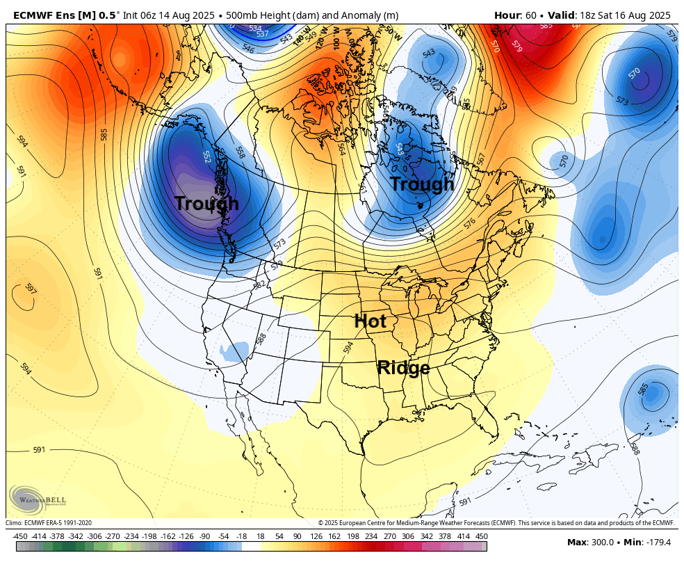
Figure 1. 500-mb height anomalies on Saturday afternoon.
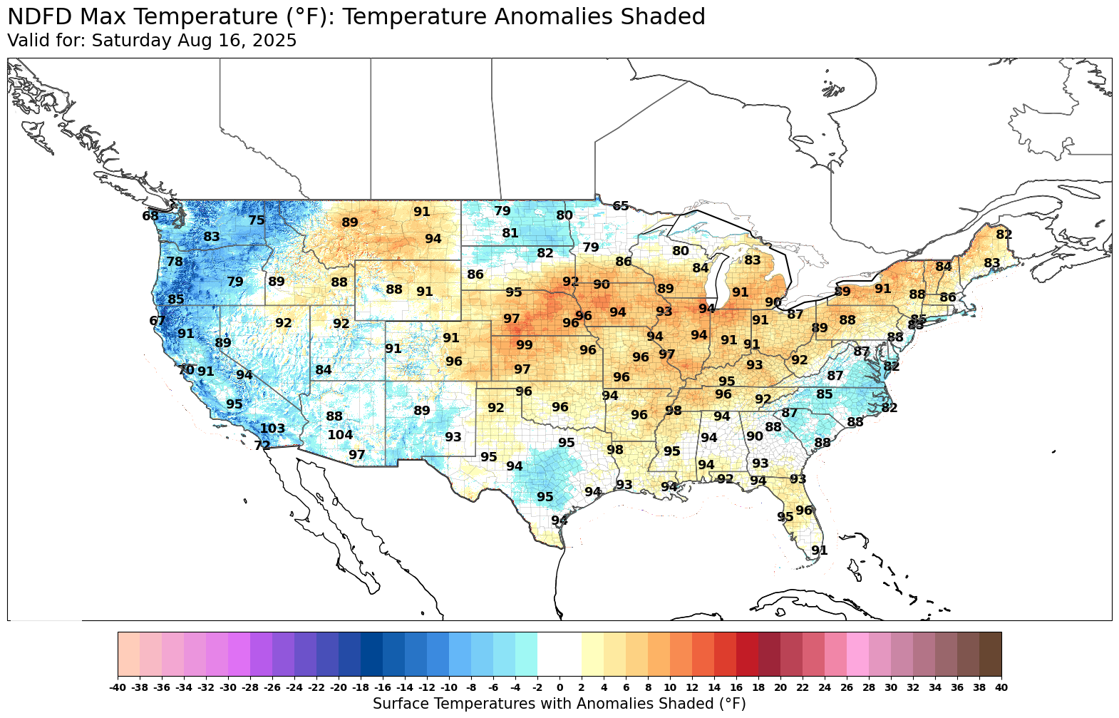
Figure 2. Forecast high temperatures on Saturday
Dewpoints also will be in the upper 60's to low 70's (central) and as high as the mid 70's (east), which will bring heat index values decently into the triple digits. Heat advisories have posted for the next two days for much of the state and may extend into Sunday and Monday for southeast Nebraska. The good news is there will be a reasonable breeze across most of the state the next few days, especially in southern and eastern sections of the state.
Storm chances return
As we head into next work week, the ridge will start to move back to the west and will put most of the state in northwest flow. We are also likely to see a series of shortwaves riding along the periphery of the ridge over the next several days. That will bring a chance of late afternoon and evening storms in the Panhandle and north central Nebraska the next few days.
Most of the storm activity this weekend will be to our north. But by early next week, there will be a reasonable chance at getting shortwaves pushing back into the the eastern 1/3 to 1/2 of the state. This will open up better chances of showers and thunderstorms by Monday night into Tuesday morning.
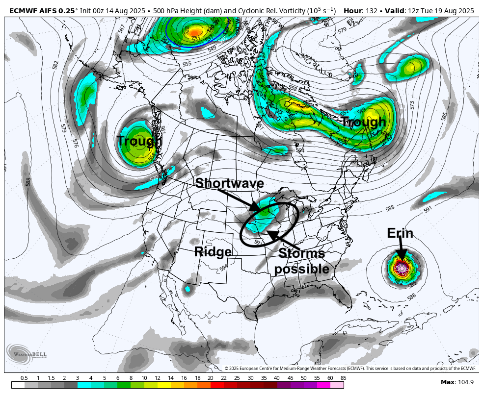
Figure 3. 500-mb vorticity map
The WPC is not bullish on significant precipitation falling between Monday and Tuesday night. But given the copious amount of locally sourced moisture in the region, it wouldn't be too surprising to see a more potent complex of storms roll through areas east of Highway 281. Will also need to watch the northern section of the state for potential for storms on Sunday night into Monday.
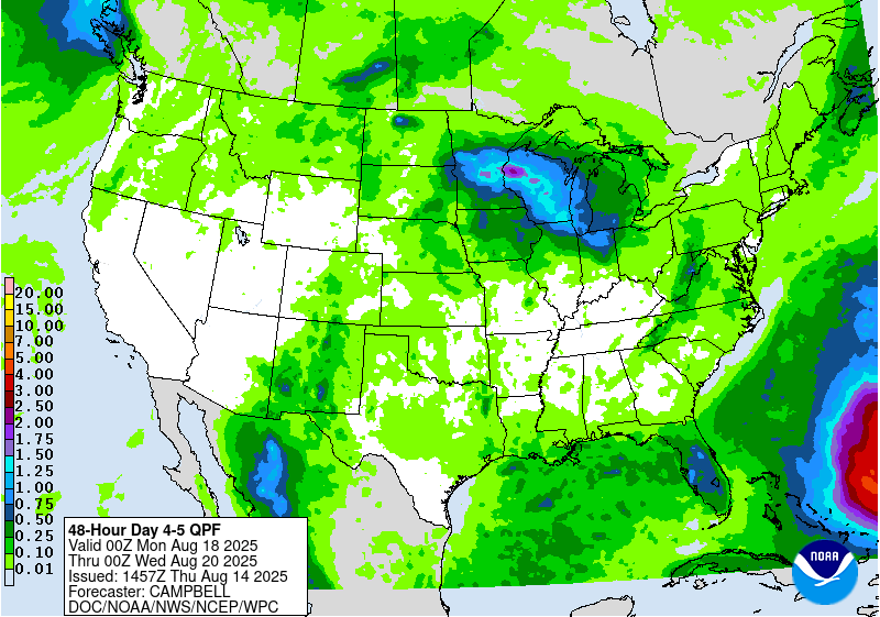
Figure 4. WPC precipitation projections between Sunday night and Tuesday night
Later in the week there may be another series of shortwaves rolling through the central section of the state, which would allow for at least chances of storms. But at this time the later part of next week looks to be mostly dry across the state.
Cooler temperatures coming
As the ridge moves west, the heat will also shift west. Temperatures should start to cool down a little on Monday in the northern part of the state with relief coming to more areas by Tuesday and Wednesday. The western portion of the state is likely to have a longer stay in the 90's as it will be closer to the ridge axis. Timing of shortwaves and associated precipitation and cloud cover will also have an impact on maximum temperatures. Regardless, the entire state should get a bit of a break from the heat during the middle of the week. Temperatures may creep back into the upper 80's and 90's by next weekend as the ridge briefly builds back north.
Stormy start to week after next?
There are signs that the western ridge will begin to flatten next weekend and a more potent shortwave may enter the state around the 24th-25th. If that ends up being true, there may be a healthy complex of storms to contend with to start the week after next. The CPC is showing a more active monsoon setting up over the southwest next week with the position of the ridge and is showing above average precipitation being possible in much of Nebraska in the 8-14 day period. Temperatures likely will cool off to seasonal and perhaps even to seasonally cool levels for a few days around the 25th.
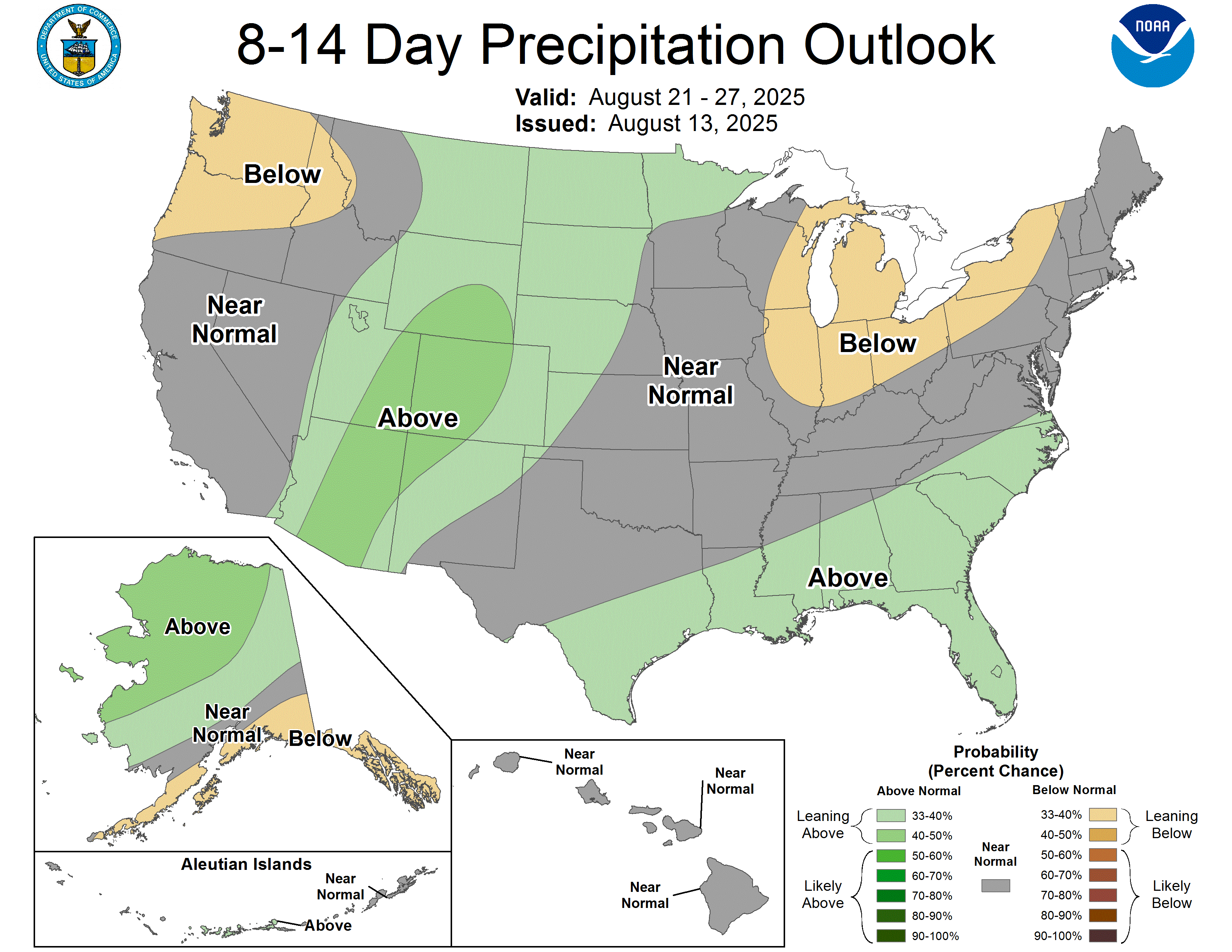
Figure 5. CPC's 8-14 day precipitation outlook