
Record setting ridge
The southeastern U.S. has been sitting under a massive, record setting ridge for the time of year. Almost all sites down there had 500-mb heights of 600 decameters or more on the 00Z sounding from yesterday evening. Those numbers would be impressive in mid-summer and are essentially unprecedented for mid-September. That area has been hot and dry this week and will remain that way for a little while longer yet. Around the periphery of the ridge, upper-level moisture has been coming around from the Gulf and back into our region. With a frontal boundary sitting near us and shortwaves around the periphery of the ridge, we have been getting routine showers and storms for much of the southeast quadrant of the state all week. Some areas have had over 5" and 2"+ has been widespread.
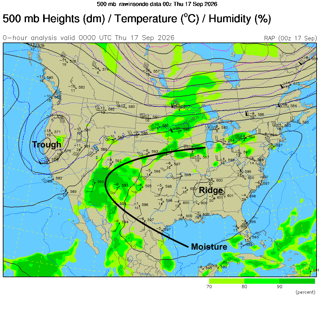
Figure 1. Analysis of the 500-mb level from yesterday evening (00Z).
That ridge is starting to shift back to the west, which will push the best chance of storms in the next 24 hours into the western part of the state. Severe weather is possible but the biggest threat would be localized flash flooding in areas that have more prolonged rates of heavy rain. WPC projects the heaviest rainfall will be to our north, but the northern Panhandle and Sand Hills could see over an inch of rain.
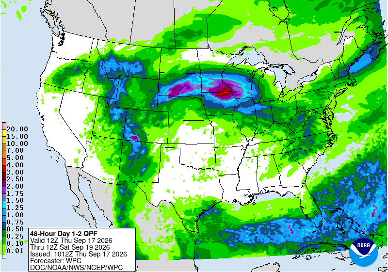
Figure 2. WPC's projected rainfall totals
Warm and muggy day Friday
A cold front will be moving through the state during the day tomorrow. The eastern side of the state will be back in the warm sector and temperatures will surge into the 80's and 90's. It also will be quite humid along and east of Highway 77 with some recent HRRR runs suggesting dewpoints could get into the mid to upper 70's. Heat index values could exceed 100°F in spots.
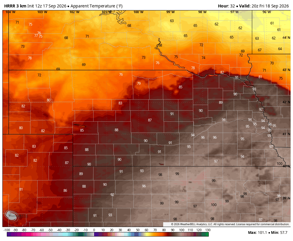
Figure 3. Projected heat index values tomorrow afternoon
Thunderstorms are also going to possible along the cold front tomorrow evening in southeast Nebraska with additional thunderstorms probable in western Nebraska later Friday night into early Saturday morning as a shortwave comes out from the Rockies.
More rain on Sunday
A shortwave trough will move into the northern Plains late Saturday into Sunday and an area of enhanced rising motion is likely to exist between I-70 and I-80. This will open up a good chance for showers and storms from Saturday night into Sunday across the southern half of the state. There is a chance that the second half of the football game could be affected, though the best chance in Lincoln will be after midnight. WPC puts the heaviest rainfall to our immediate south and southeast but a half inch to an inch will be possible along and south of I-80.

Figure 4. Projected 500-mb anomalies on Sunday morning
Prominent cloud cover and additional chances of rain
Most of the state will be on the cloudier side in the first half of the week, particularly in the eastern half of Nebraska. This will keep afternoon temperatures below average in the mid 60's to lower 70's but keep overnight temperatures around average or somewhat above. Humidity levels are likely to remain elevated for much of next as well. Rainfall chances will be lower on Monday statewide but will pick up again on Tuesday across western Nebraska and by Wednesday in the eastern half of the state as additional shortwave energy moves around the southern ridge.
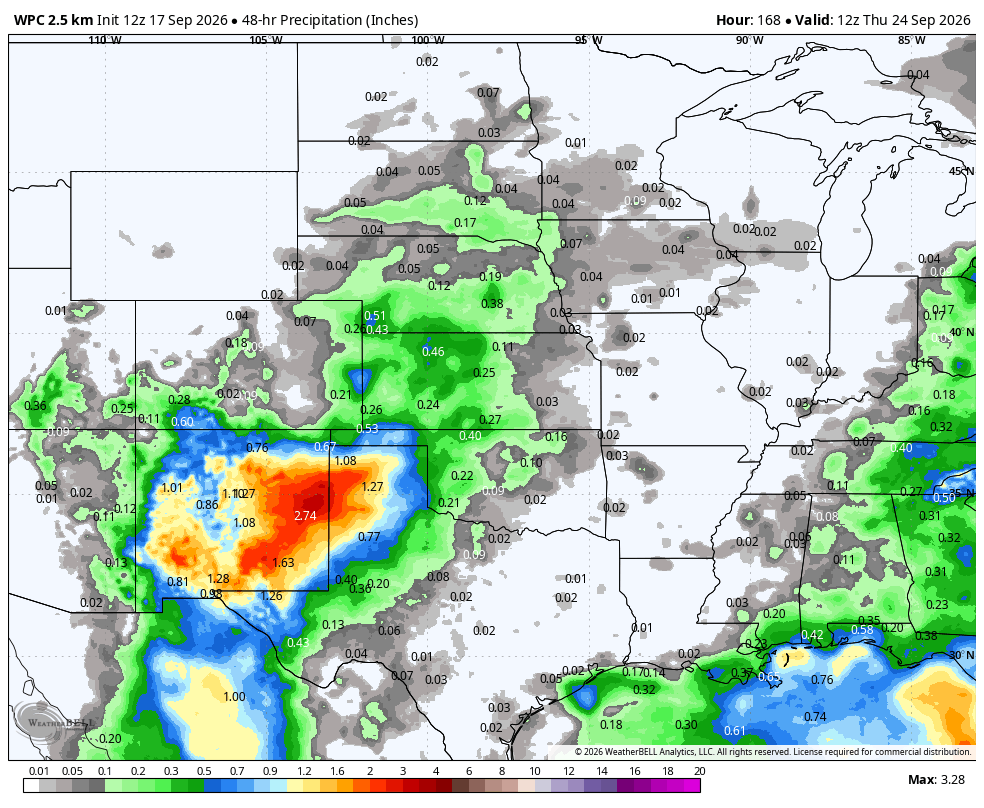
Figure 5. WPC's projected precipitation totals
Late September likely to be wetter than average
The CPC's 8-14 day outlook shows above average precipitation favored to close out the month for the entire state. Recent ECMWF ensemble runs have been showing above average favored in the entire state and through much of the Corn Belt.
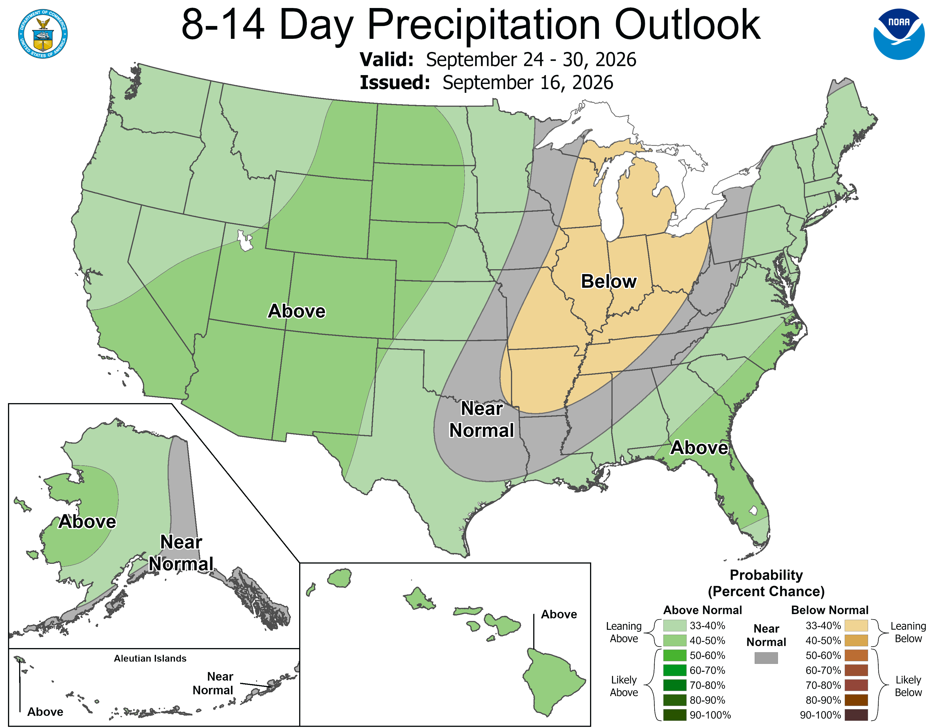
Figure 6. CPC's 8-14 day outlook
This is largely a reflection of the expectation of the presence of upper level ridging over south Texas, which will help push moisture from the subtropical jet into our region, which in turn would enhance rainfall. This does not necessarily mean there will be rain and thunderstorms every day across the state. But there also is unlikely to be more than 48-60 hours without rain to help things dry out in areas that need that.
The polar jet (most commonly known as the jet stream) will remain well to our north for the foreseeable future. This means that on balance temperatures (especially nighttime temps) are likely to remain above average to close out September into early October. Thus, frost risk outside of the higher elevations of the Panhandle looks very low for the next few weeks.

Figure 7. Projected 300-mb map for next Thursday


