Colder weekend
Troughing over the Great Lakes region this weekend will lead to colder air coming into this region of the country. Saturday will be the coldest day statewide with highs generally in the 30's. It is possible that the northeast quadrant of the state will remain below freezing all day on Saturday. Temperatures begin to moderate across western and central Nebraska on Sunday as ridging builds in from the west. Snow showers will be possible in eastern Nebraska on Saturday afternoon, though no significant accumulation is expected. Winds will be breezy on Saturday so visibility may be briefly reduced in areas getting snow showers.
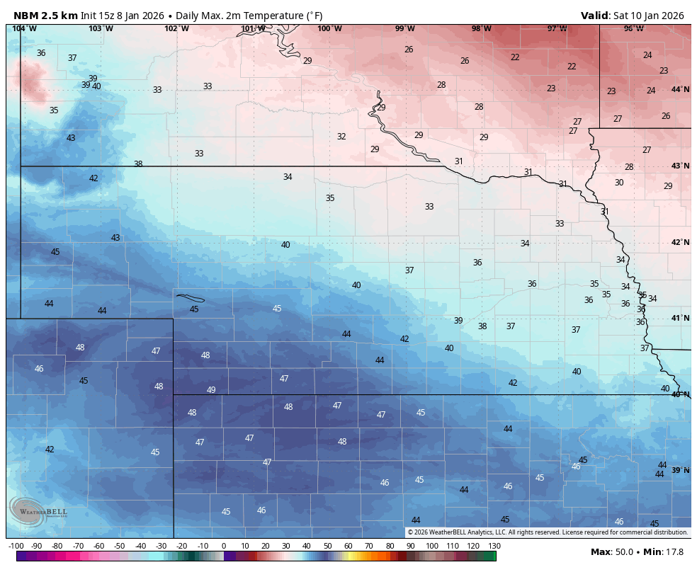
Figure 1. Projected high temperatures on Saturday according to the National Blend of Models.
Mild weather Monday and Tuesday
Upper-level ridging will be prominent over the High Plains region early in the week and this will lead to a mild start to the week with well-above average highs in the 50's and 60's across the state. Monday will be the warmest day in western Nebraska (upper 50's to mid 60's) while Tuesday will be warmest across central and eastern Nebraska (mid 50's to lower 60's). Temperatures may even flirt with record highs on Tuesday around Omaha if there is ample sunshine.
Mid-week cold front
Ridging will build along the west coast by mid-week and northwest flow aloft will become prominent. At the surface a cold front will push through the state and will temperatures that are closer to seasonal levels. Highs likely will be in the 40's across most of western and central Nebraska with 30's being more likely in the eastern side of the state. Winds will be a bit gusty from the northwest. This front is most likely going to come through dry but there will be a slight chance of showers or snow showers
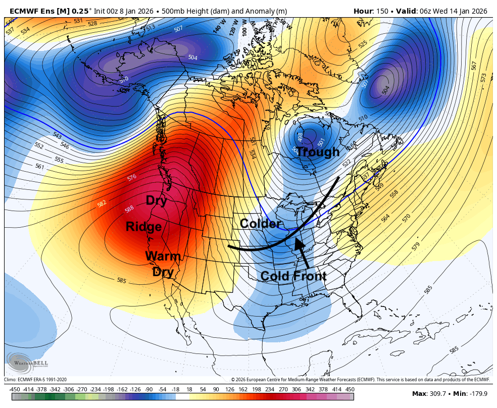
Figure 2. Projected 500-mb height anomalies next Wednesday
Cold next weekend. Snow chances?
Temperatures likely will rebound on Thursday before another cold front comes through on Friday. With deeper troughing over the Great Lakes and ridging building up toward Alaska, this will help open up the polar express into the north central U.S.
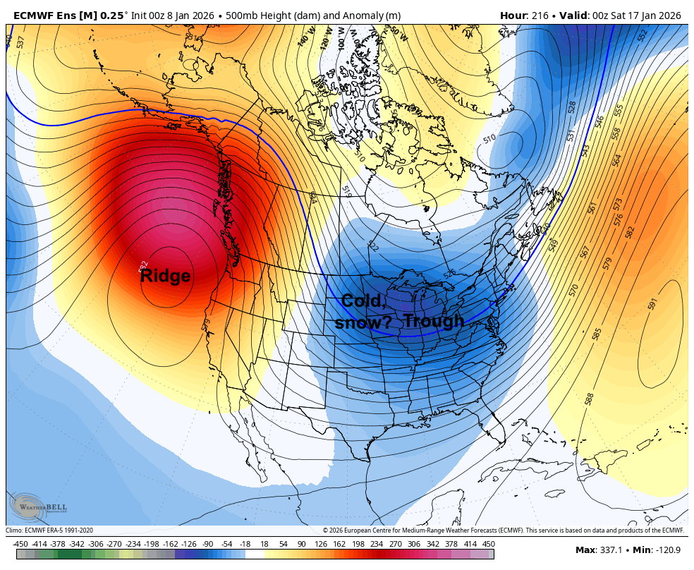
Figure 3. 500-mb height anomalies next Friday evening
A series of modest shortwaves will be rolling through the region, which would help open up chances for snow between Friday night and the following Sunday. Too early to pinpoint exact timing of snow and amounts, though it is unlikely that significant snow would fall. Temperatures are likely to be much more seasonal, perhaps even quite chilly in eastern Nebraska at the beginning of next weekend. Even colder weather may be possible later in January but next weekend's cold snap appears to be more of a quick shot than a more prolonged stretch of cold.
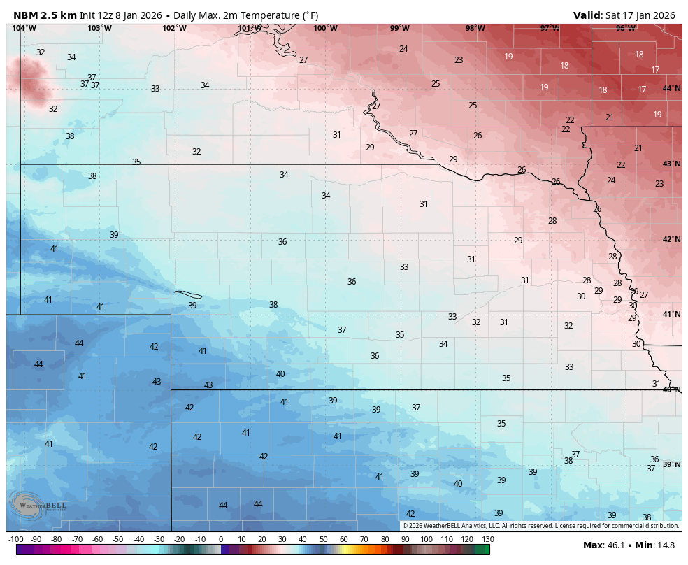
Figure 4. Projected high temperatures next Saturday