Exceptional drought
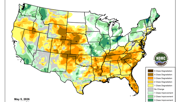
The latest U.S. Drought Monitor was released this morning and revealed additional degradation across west central Nebraska and the Panhandle. The good news is the percentage of the state in drought is still less than it was in late March and we still see the southeast corner enjoying relatively good conditions. The bad news is we still are seeing degradation out west and there was an expansion in the aerial coverage of both extreme and exceptional drought this week.
That includes more extreme drought (D3) around North Platte, expansion of D4 in the Panhandle, and introduction of exceptional drought (D4) between Lexington and Curtis. 12 of 93 counties now have some portion of them in D4 and every county west of Highway 183 has a majority of its area (if not the entire county) in D3. For the Panhandle, this is the worst conditions have been in early May since the Drought Monitor started tracking drought in late 1999 and is likely the worst conditions have been in that region for decades. I think it's probable that this is the worst drought the area has had at least since the 1930's.
Figure 1. Latest U.S. Drought Monitor based on data through May 5th.
Cattle country stressed
QuickDRI shows most of Nebraska (outside the southeast corner) is dealing with at least some form of vegetation stress compared to what is typical for early May. The vegetation stress is particularly acute in the Panhandle, eastern Wyoming, and down into the southern High Plains.
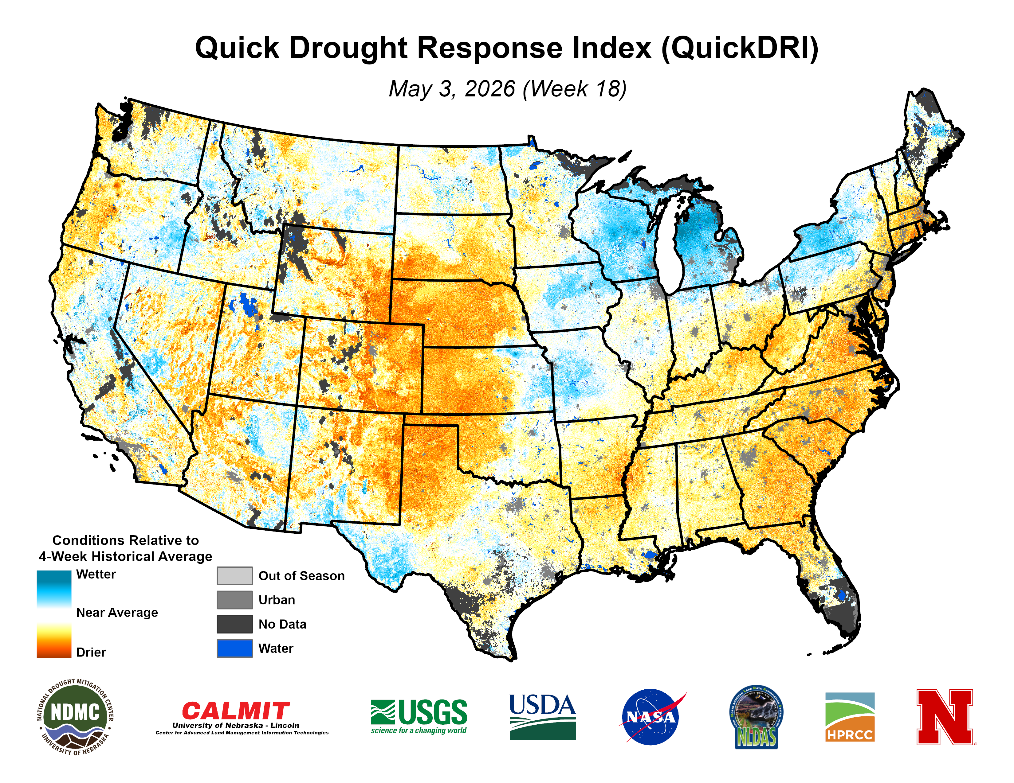
Figure 2. Latest QuickDRI map
This is also where a large share of U.S. cattle are and Figure 3 shows that over 60 percent of cattle country is currently experiencing some form of drought. Much of that 60 percent is in D2 (severe drought) or worse meaning that pastures are likely going to be well short of normal forage production this growing season if rain doesn't start falling regularly soon.
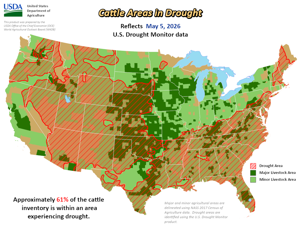
Figure 3. Percentage of cattle country in drought according to the USDM and the USDA.


