Wet weekend possible
A look at the upper level water vapor analysis (Figure 1) reveals two troughs that will have an impact on our sensible weather in the coming days. The first is very slowly working its way through the southern Plains and the second (and more potent, deep one) is located over northern California and moving its way east. There is a decent fetch of moisture being drawn back into the Central Plains currently and most of Kansas is getting a nice rain today. As the best rising motion shifts north-northeast over the next 24 hours, the rain will get into southern and eastern sections of the state. There may be localized areas of heavy downpours later tonight and tomorrow. But in general, rainfall amounts will be under a quarter of an inch.
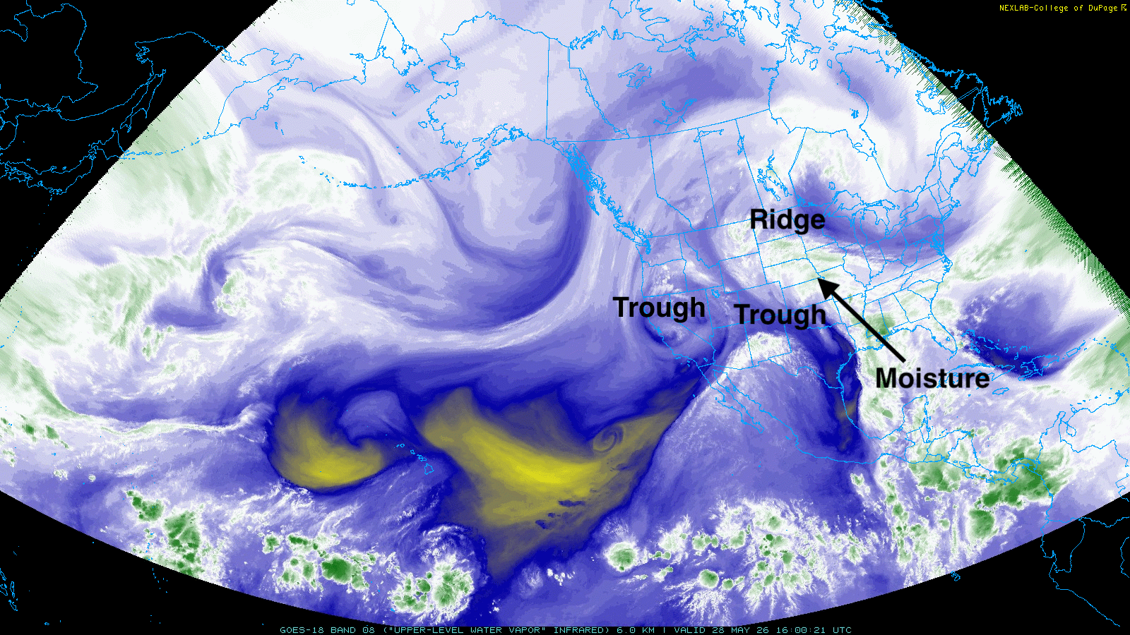
Figure 1. Upper level water vapor analysis
The next trough will be moving east through the Great Basin before making a northward turn into the northern Rockies. Moisture return looks adequate and the rising motion ahead of the main trough will open up chances for showers and storms statewide, with chances for more significant precipitation in the Sand Hills on Saturday night. Additional chances for showers and storms look probable early next week as another shortwave moves into the central Plains, with potential for more significant precipitation in central and southeastern sections of the state. Total precipitation between this afternoon and Tuesday afternoon could be over 2" from Ainsworth and O'Neill down to Lincoln and Beatrice. Lower amounts expected (unfortunately) in the western Panhandle and southwest sections of the state.
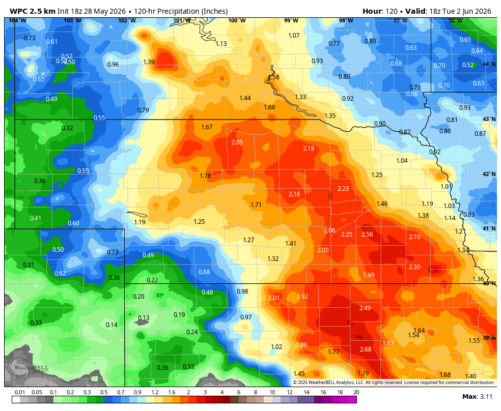
Figure 2. Projected precipitation through next Tuesday afternoon according to the WPC
Warm temperatures
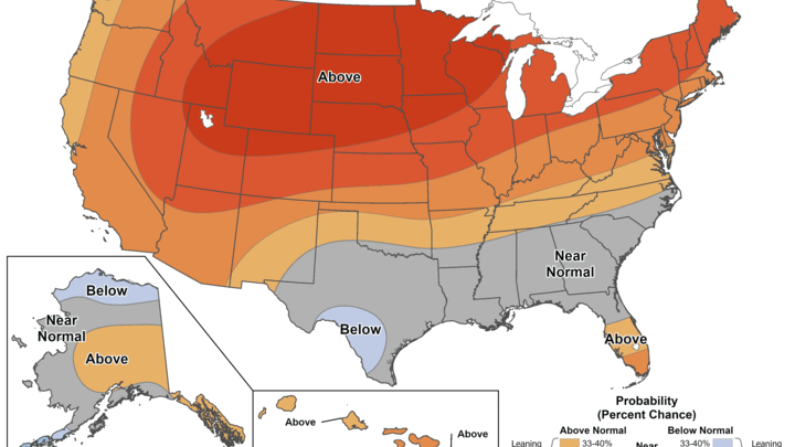
The ridge that is currently in place over southern Canada is expected to remain in place for much of next week (Figure 3). This will help keep above average temperatures in place over the north central part of the continent and will keep the Great Lakes region on the dry side. Expect highs generally to be in the 80's next week with lows in the 50's and 60's. There will likely be one more upper level low sneaking into the central U.S. under the ridge later in the week that would help bring additional chances for rain and storms. Afternoon temperatures could be affected by this but no seasonally cool air is likely to pay us a visit anytime soon. June has the sharpest warming trend of any month in Nebraska and 2026 doesn't look to deviate off this trend.
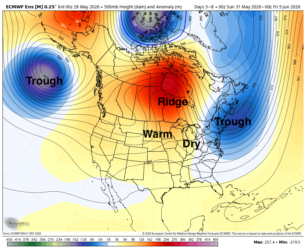
Figure 3. Projected 500-mb height anomalies next week


