
Heat continues
Temperatures have been on the warm side of late, especially in the northwestern part of the state, and the heat will pick up this weekend into early next week as the upper level ridge starts its move toward the southwest.

Figure 1. Projected 500-mb height anomalies next Monday
Temperatures will be well into the 90's statewide this weekend and look to peak on Monday with highs in the upper 90's to lower 100's. It's worth noting that high temperatures have generally been cooler than expected this week, so it's possible these numbers from the National Blend of Models are too bullish on the heat. Nevertheless, it will be quite hot early in the week and with modest humidity in the eastern half of the state, the heat index will likely exceed advisory criteria at least on Sunday and Monday.
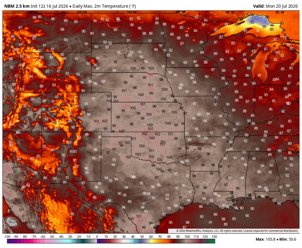
Figure 2. Projected high temperatures next Monday, July 20th.
Cooling off
A cold front will enter the state from the north and west during the day on Monday, which could bring some relief to the Panhandle and northern sections compared to Sunday. It is possible thunderstorms will develop along the front on Monday evening for areas along and south of the Platte. This is starting to be suggested in the ECMWF AI model but chances as of now are low due to expected atmospheric capping.
But a boundary pushing up against hot, humid air in the summer will generally mean at least a slight chance of storms. Temperatures on Tuesday will be cooler statewide with highs in the 80's and lower 90's, with even cooler temperatures for Wednesday when highs in the mid 80's are likely statewide. Temperatures are likely to remain at or slightly below seasonal averages on Thursday and possibly through the remainder of the week. The break in heat will be welcomed by crops and livestock both.
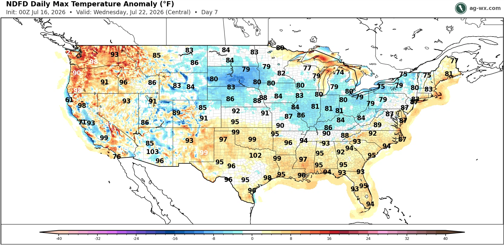
Figure 3. Projected high temperatures on Wednesday.
Storm chances
The ridge shifting to the south will also help bring chances of showers and thunderstorms back to the state. It appears there will be chances for late afternoon to overnight storms starting on Wednesday and going through the weekend. Exact placement and timing of said storms is hard to pinpoint as are the amounts. But everyone in the state has a chance to pick up an inch of rain between midweek and next weekend and recent ECMWF ensemble runs have been more bullish on above average moisture falling between July 22 and 28, especially in the western half of the state. Temperatures will also be affected by any residual cloud cover that hangs around for most of a morning later in the week.

Figure 4. Chance of 1" through next Saturday according to the ECMWF ensemble
Heat coming back in late July
The CPC's 8-14 day outlook shows above average temperatures favored across the southern and western U.S., with cooler than average across the northeastern part of the U.S. There is some signal in the models for a sizable ridge building back toward the central Plains late in the month. This would bring back temperatures in the 90's (or higher) and also probably reduce or shut down rain chances.
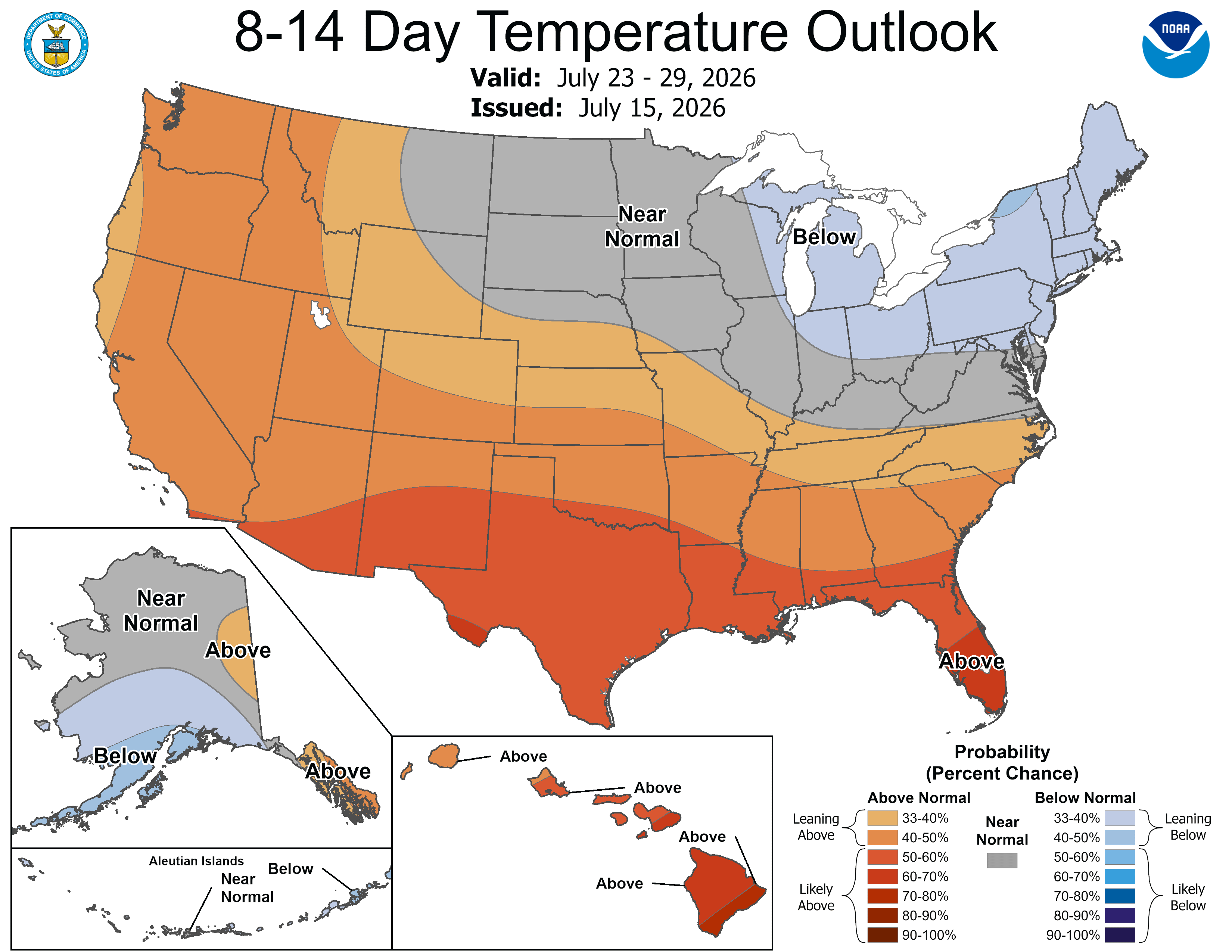
Figure 5. CPC's 8-14 day outlook


