
Hot west, storms possible east tomorrow
A large upper level ridge is in place over the southwestern U.S. and the western portion of the state is in closer proximity to it. This will lead to a hot day tomorrow with highs in the 90's, with 100°F possible in the southwest corner. Thunderstorms are likely to develop early in the morning across eastern Nebraska and slide southeast into Iowa and Missouri in response to another shortwave coming in from the northwest. How extensive those storms and associated cloud cover are will go a long way in determining how warm it is in central and eastern sections tomorrow. A lack of storms and more sun would lead to widespread 86-91°F with some humidity.
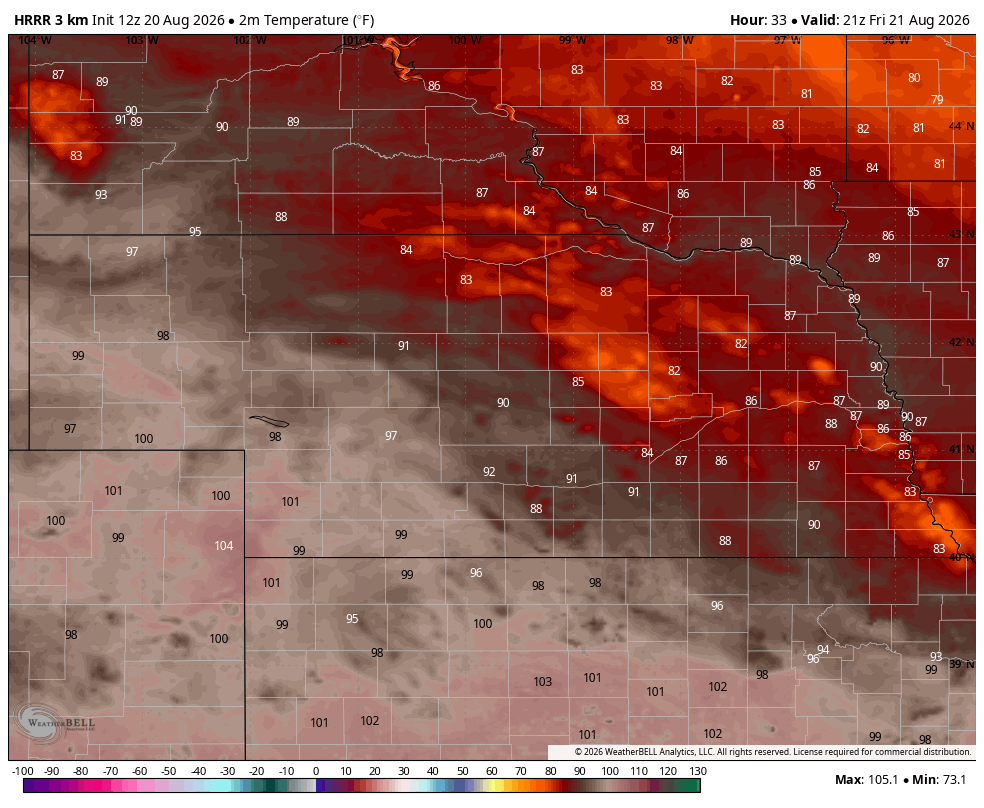
Figure 1. Projected temperatures tomorrow afternoon by NOAA's HRRR.
Active pattern with seasonal temperatures
By early next week that ridge at 500-mb will likely have slid a bit further to the east and south and centered over New Mexico.

Figure 2. Projected 500-mb heights early next weekend
The growing consensus is that that ridge will remain entrenched over the southwestern U.S. through most of next week and not move northeastward. On Monday, another shortwave is expected to move into the northern Plains and open up chances for showers and storms in eastern Nebraska into Iowa. Will likely be dry west of Highway 281 and will be a hot day in western Nebraska with highs in the 90's.
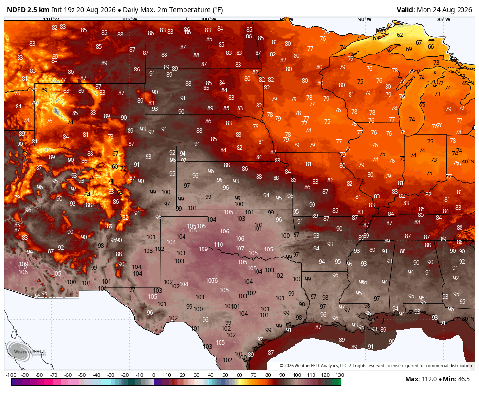
Figure 3. Projected high temperatures on Monday
A cold front associated with a Great Lakes trough will move into the state Tuesday into Wednesday. Showers and storms will be likely in the eastern 1/2 to 2/3 of the state and there may be areas that receive excessive rainfall. A look at analysis from NOAA'S HYSPLIT shows moisture coming around that southwest ridge from the Gulf and getting infused with Pacific moisture as well.
Translation: Thunderstorms with flash flood potential will be a risk the middle of next week.
Recommend paying attention to the forecast early next week. As it is, the ECMWF ensemble is showing a good chance of over an inch over the next 10 days for all but the Panhandle. Better chances for moisture in western Nebraska come in later next week as that ridge slides west.

Figure 4. Probability of 1 inch or more of rain through August 29th
Worst of heat staying south
It will be rather hot early next week in western Nebraska but the worst of the heat is likely to remain south of the state border next week and to finish out the month.
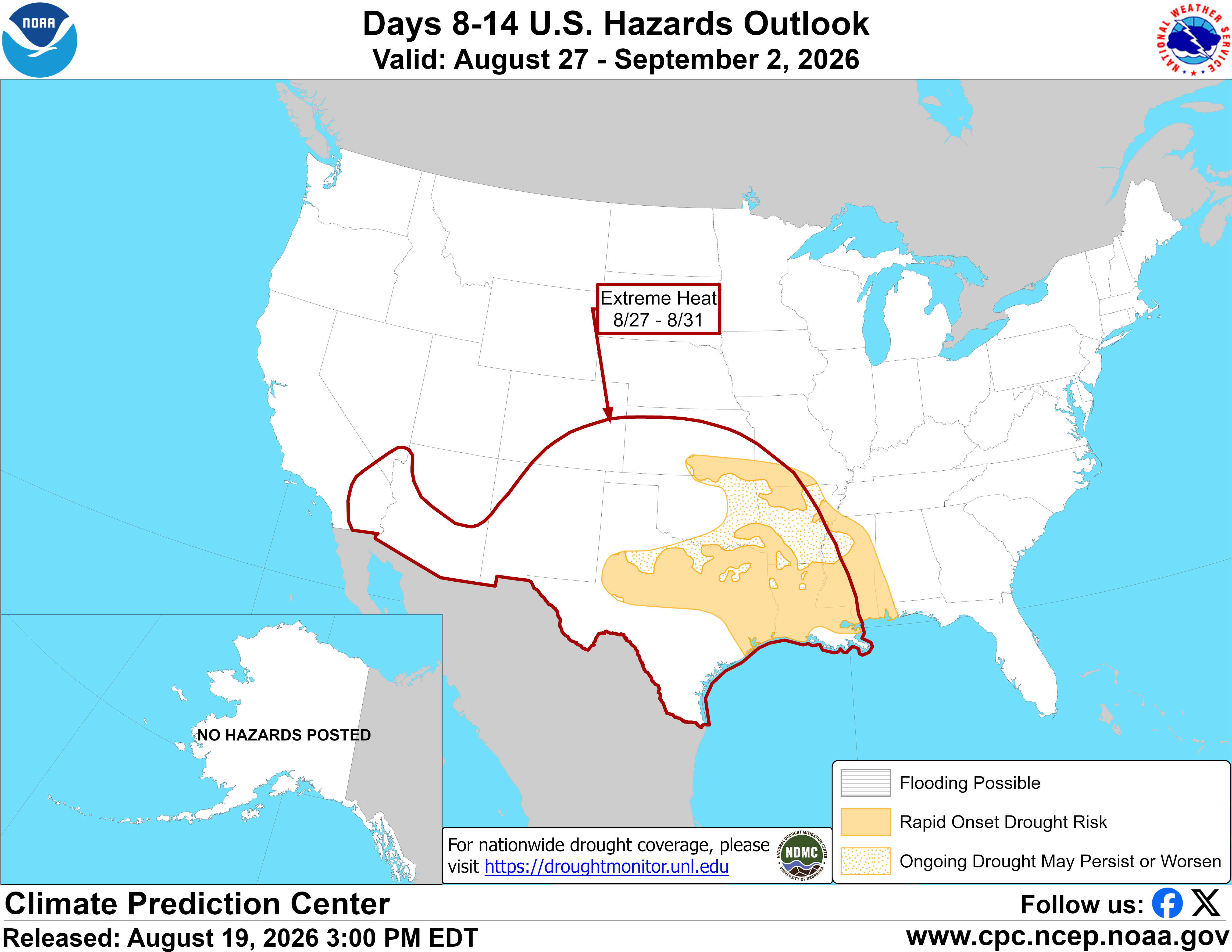
Figure 5. CPC's 8-14 day hazards
The ECMWF ensemble shows temperatures being about average in the eastern 3/4 of the state with above average in the Panhandle in the 8-14 day outlook, which is cooler than the CPC's 8-14 day outlook of above average favored through the entire mid-section of the country.
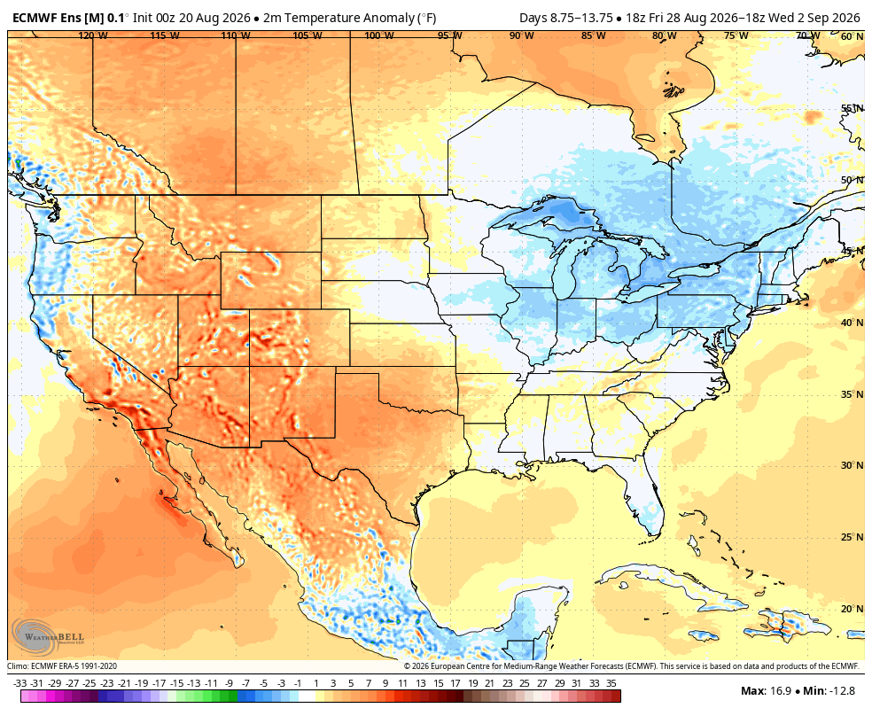
Figure 6. ECMWF ensemble temperature outlook from August 28-September 2.


