
Warm weekend ahead for most
A look at current temperatures shows a pleasant morning in the Panhandle with 50's and lower 60's, a warm morning in west central Nebraska with temperatures mostly in the upper 60's, and a very warm morning in eastern Nebraska with temperatures in the 70's and 80's. The morning low of 79°F at the Lincoln airport will be the second consecutive day with a record warm low temperature in Lincoln should that observation hold through midnight (which is likely). That also is a relative cool spot- the Walton 5 NW Mesonet site only dropped to 83°F. That would be good for the warmest ever minimum temperature in Lincoln during the month of September if it holds. The heat will not be going anywhere the next few days either with highs in the 90's statewide.
The good news is that there will be a chance for storms along and south of the Platte River later tomorrow afternoon into early Saturday morning. It's not likely that there will be significant widespread rainfall, but certainly some places may get a little drink of moisture. Best chance will be in southwest Nebraska. Temperatures will remain hot on Saturday, especially in southern and eastern sections of the state. Anyone planning to come to town for the game on Saturday should prepare for construction and also for it to be hot. Heat advisory criteria may not be reached but the heat index will likely top out over 100°F during the second half.
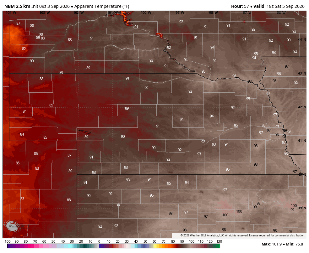
Figure 1. National Blend of Models projected heat index values on Saturday morning
Backdoor cold front?
Recent model runs suggest an area of stronger high pressure will settle into the upper Midwest by Sunday morning, which could push a backdoor cold front in from Minnesota and Iowa through the eastern half of the state. This would lead to slight chances of storms early on Sunday for the eastern part of the state. This also would bring cooler air in from the east. If the front comes through a bit earlier than currently anticipated, most of the state should see highs in the 80's. If it's a little later, temperatures likely will get into the 90's in the early afternoon before dropping. Regardless, temperatures are likely to be more pleasant on Sunday night and Monday morning for areas dealing with intense heat of late.

Figure 2. Projected 500-mb anomalies on Sunday evening
By later Sunday into Monday, a western trough will start to move northeast and a surface low is expected to develop in Wyoming. This will open up chances for showers and storms for most of the northwest quadrant of the state. The WPC does indicate potential for a quarter to half an inch between Chadron and Valentine. Severe storms with hail may also be possible on Sunday night, though the SPC does not currently have any severe weather risk highlighted in their Day 4 product. Something to watch for though. As we saw the other night in Crofton and Fordyce, destructive storms can occur in a slight risk.
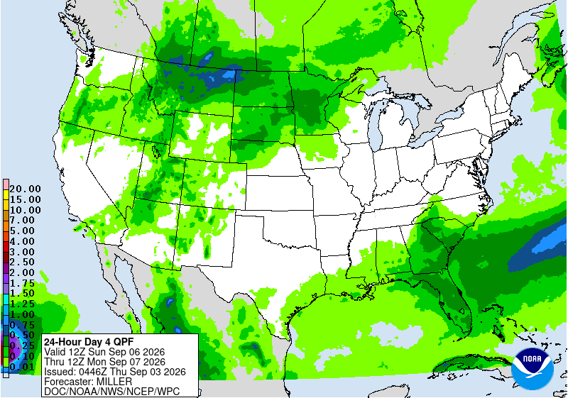
Figure 3. WPC projected precipitation between Sunday and Monday
A decent cold front?
Temperatures will remain warm on Labor Day with highs in the mid 80's (west) to mid 90's (south central). By Tuesday we may see a more meaningful cold front slide into the state from the north and west as an upper-level trough moves into southern Canada from Montana.

Figure 4. Projected 500-mb height anomalies on Tuesday afternoon.
Assuming this is not a false signal, which is not a guarantee with recent model performance, thunderstorms would be probable across the southeastern half of the state. The WPC is not that bullish on significant moisture but some of eastern Nebraska could certainly get some decent moisture. Temperatures will be cooler on Wednesday statewide with highs in the 70's and 80's instead of upper 80's to mid 90's.
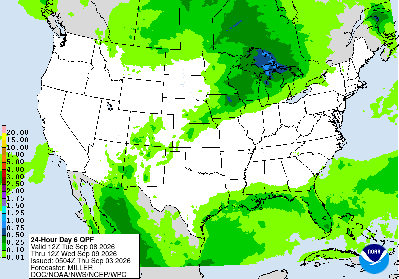
Figure 5. WPC projected precipitation Tuesday afternoon into Wednesday morning.
Another cold front looks to enter the state on Wednesday into early Thursday in response to troughing over the Great Lakes. This would bring another chance of showers and storms and another reinforcing shot of more seasonal to seasonally cool air. Temperatures next Friday morning would drop to their lowest levels in almost three months with 40's and 50's. This may be a relatively short-lived cool snap though as upper-level ridging over the southwest edges back east and brings the heat with. The CPC's 8-14 day outlook shows warmer than average favored through the middle of the month. It also shows wetter than average favored. Faucet may not totally shut off but nothing resembles true fall weather appears particularly likely before the equinox.
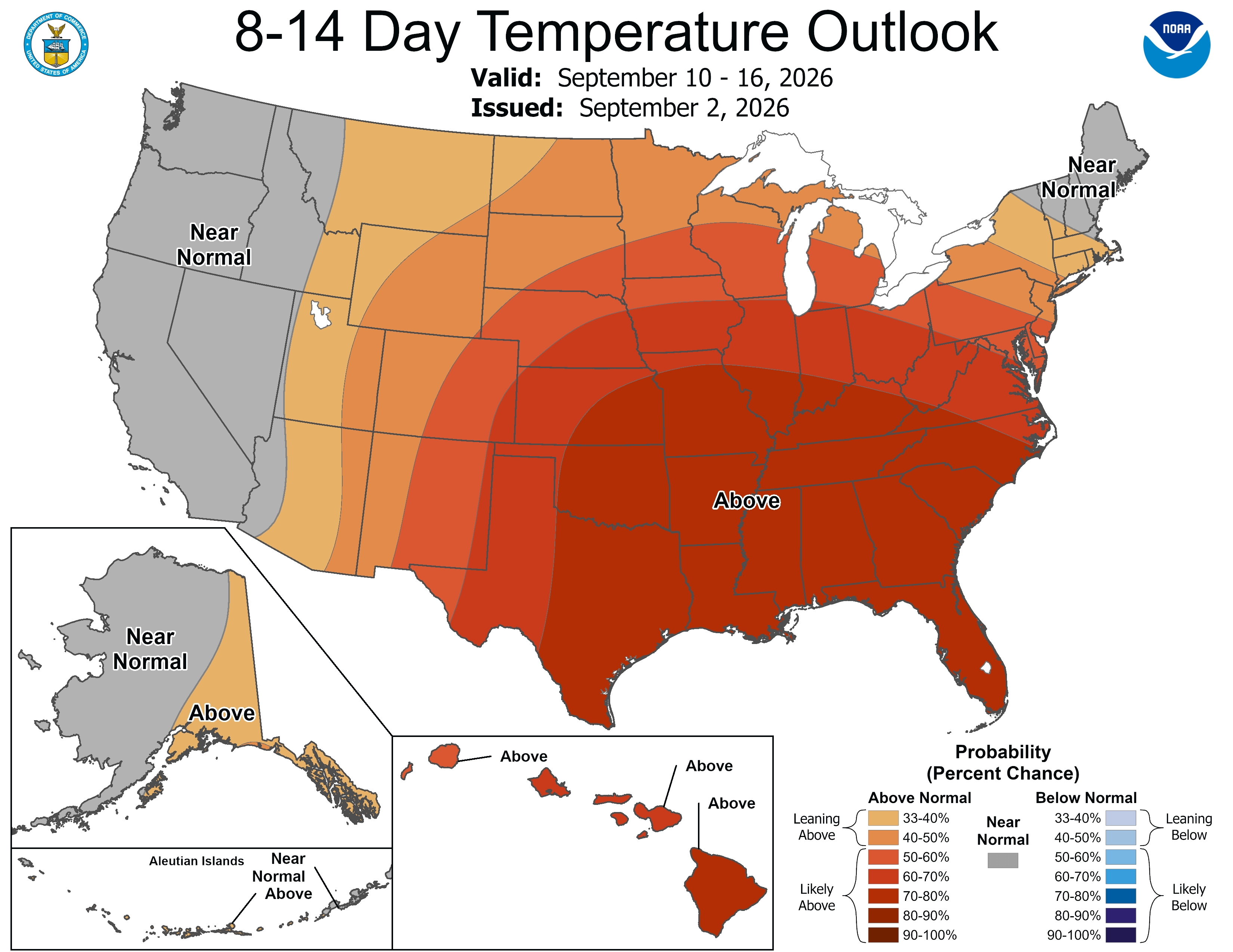
Figure 6. CPC's 8-14 day temperature outlook


