
Open planting window
Ridging will return to the central U.S. by early in the week. That will lead to warm, dry conditions prevailing across the state and the region as a whole. Highs should be in the upper 60's to mid 70's after a cold start on Sunday and likely in he upper 70's to mid 80's statewide from Monday-Wednesday.
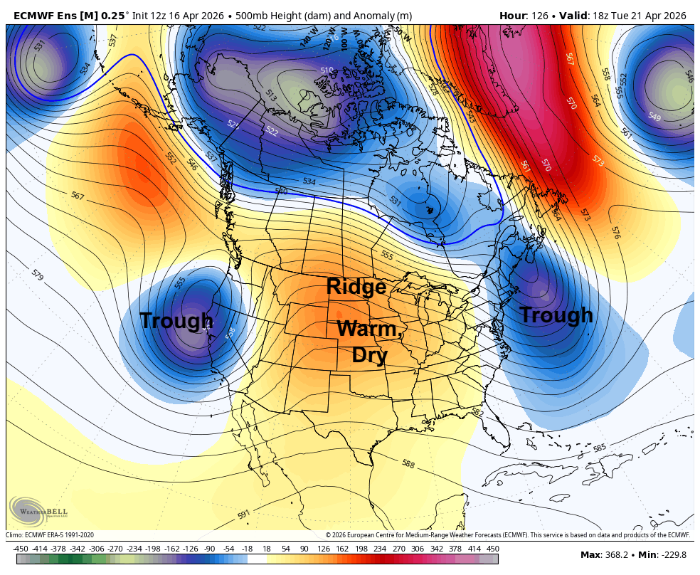
Figure 1. 500-mb height anomalies next Tuesday afternoon
Precipitation will be absent for a large section of the country in the first half of the week, which bodes well for planting for most of the Corn Belt. The drier weather certainly would be welcomed for many farmers in the central and northern Corn Belt, but this is not good news for the drought outstate. Also not good news for the southeastern U.S., which is dealing with near-historic levels of drought in spots.
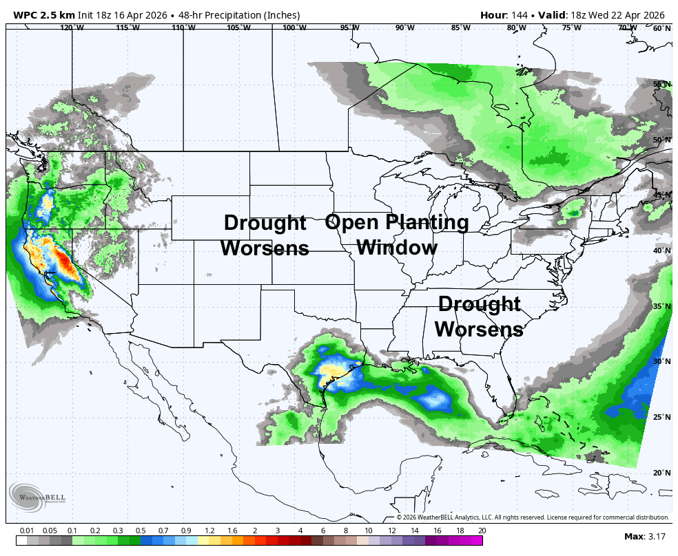
Figure 2. WPC projected precipitation between Monday and Wednesday
Elevated fire danger
It will also be relatively breezy from the south on Wednesday and Thursday, especially in the afternoons in the eastern 2/3 of the state. Fire danger will likely be elevated and perhaps at critical levels in areas between Highways 61 and 183 on Wednesday and Thursday afternoons. Fire danger also may be elevated in the Panhandle on Monday with stronger west winds and very low relative humidity. Things are starting to green up a bit, even in areas with severe and extreme drought, but the fire risk will remain until better moisture returns.
Moisture chances
We should see better chances of moisture returning later in the week. A somewhat slower moving trough looks poised to move from the southwest U.S. into the Central Plains by later in the week and we should see chances for precipitation in the western part of the state by Wednesday night and into eastern Nebraska by later Thursday.
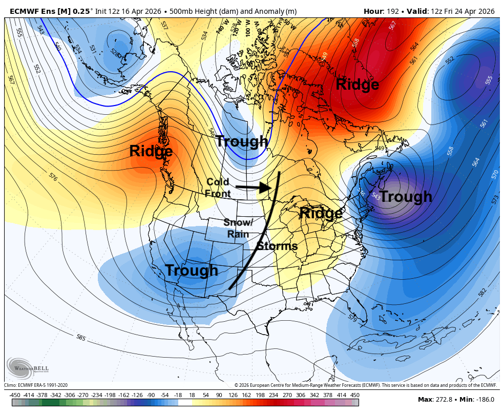
Figure 3. 500-mb height anomalies on Friday morning
Another trough in Canada will be moving down into the Northern Plains and this will help drive a strong surface cold front through the state between Thursday night and Friday. This looks to be a focal point for showers and storms ahead of it, with some severe storm and heavy rain potential in eastern Nebraska. Precipitation will also be possible on the back side of the surface low in western Nebraska, though models are in less agreement on overall precipitation potential out west. This does not look like true drought-busting moisture but it does appear that something should fall out of the sky for most of us. Additional moisture and cooler temperatures also look possible next Saturday. The ECWMF ensemble does show at least a chance of picking a half inch of moisture by later Saturday. This would be very welcome news for the Sand Hills and the Panhandle.
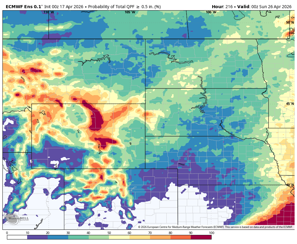
Figure 4. ECMWF ensemble probability of a half inch of moisture by next Saturday evening
Cool and possibly wet finish to April
Recent runs of the ECMWF AI have been suggesting a deep and very slow moving upper level trough in the upper Midwest early the week after next in response to polar vortex shenanigans. If this happens, we are likely looking at temperatures remaining below to well-below seasonal averages to finish out the month. Recent runs also suggest another potent trough coming into the west toward the end of the month, which would open chances for moisture statewide and also keep us on the cool side. The last few ECMWF ensemble runs have also trended wetter at the month and into early May with cool temperatures prevailing. Snow may even be possible in the Panhandle to start Monday.
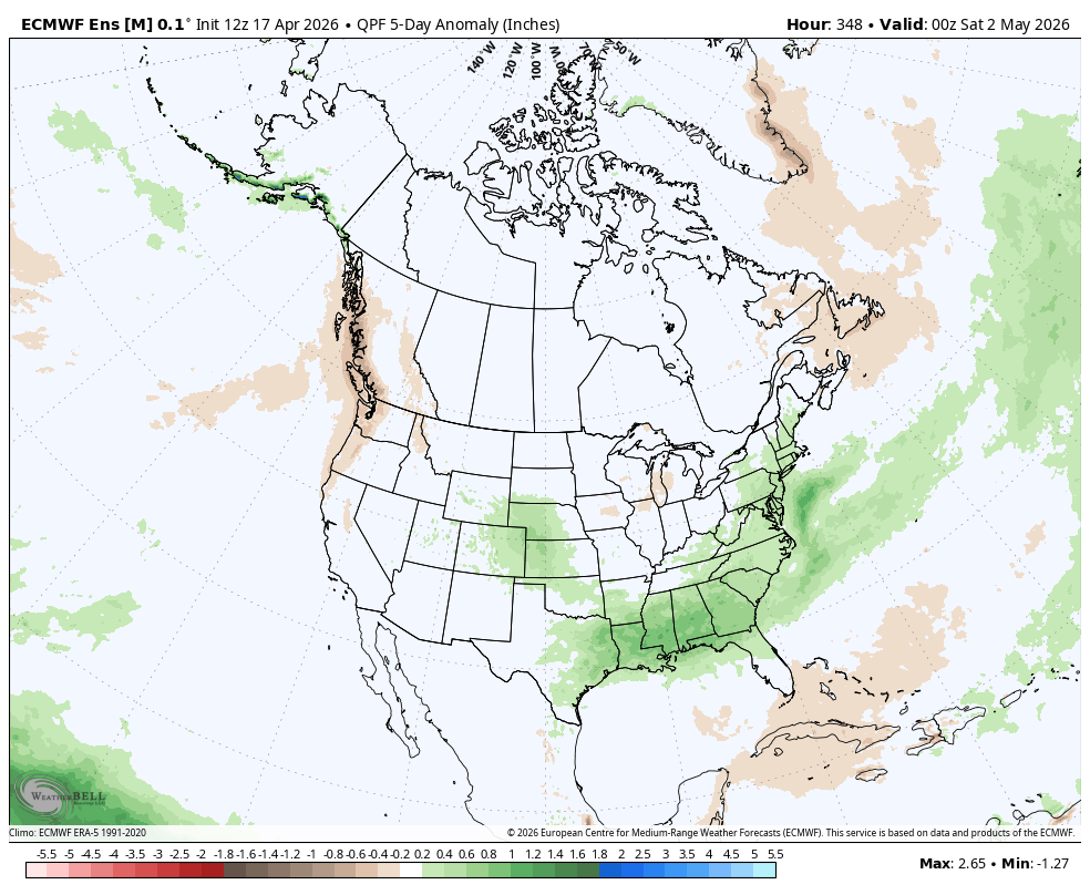
Figure 5. ECMWF ensemble 5-day precipitation anomalies between April 27-May 1
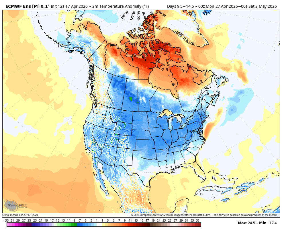
Figure 6. ECMWF ensemble 5-day temperature anomalies between April 27-May 1


