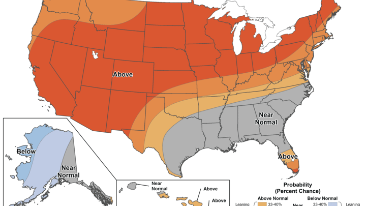
Stormy period ahead
A look at the upper level water vapor analysis shows a deep trough over Saskatchewan and another upper level low pressure area in northeast New Mexico. A frontal boundary associated with the former is situated over central South Dakota and will be a focal point for showers and storms to develop in the next few hours. Storms are likely across northern and eastern sections of Nebraska, with some severe risk, especially closer to South Dakota. How far south the storms make it is a bit in question but areas along and north of Highway 30 are more likely to get storms.
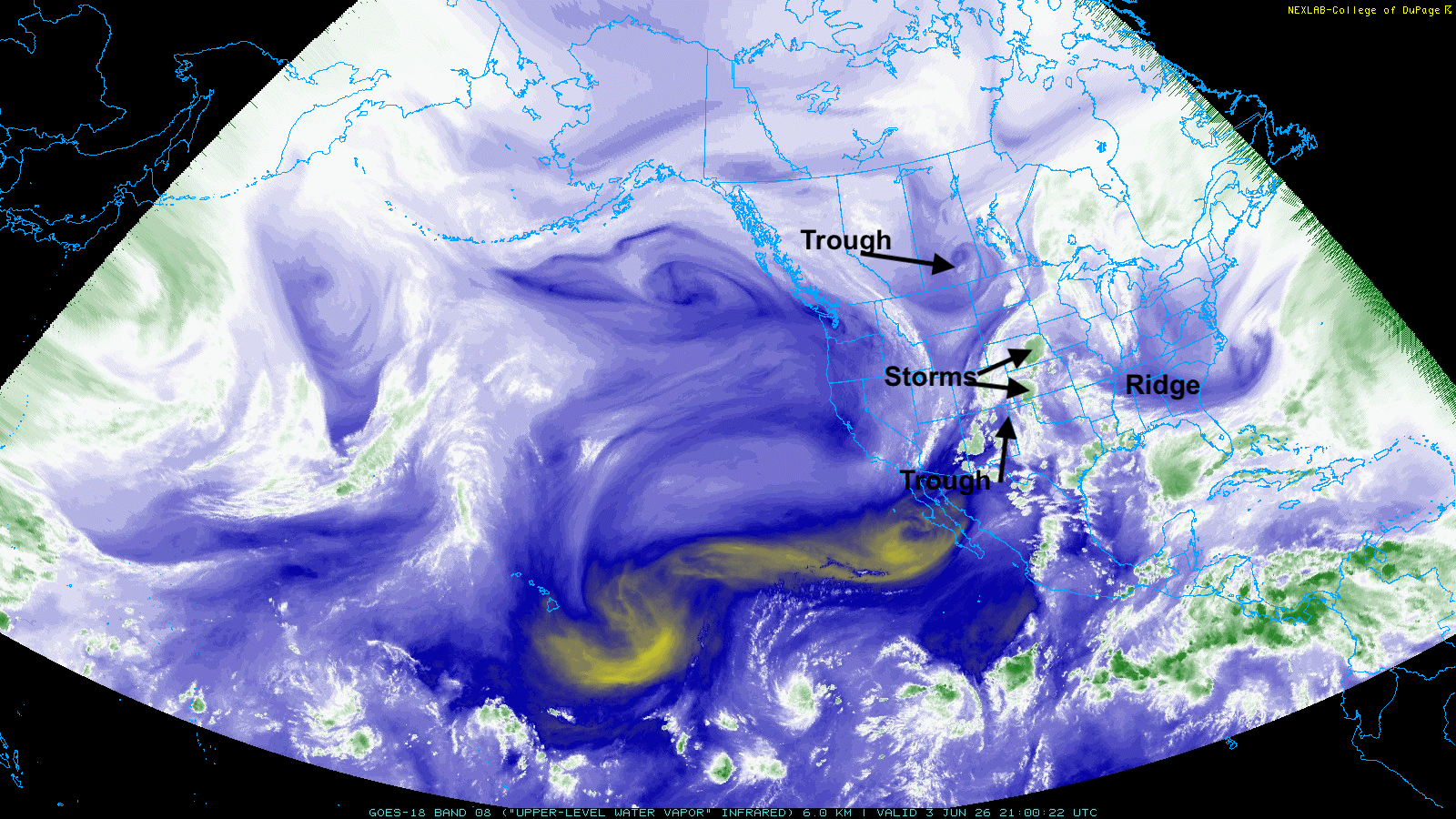
Figure 1. Upper level water vapor map from mid-afternoon on June 3rd
The trough and its associated vorticity max (Meteorology to English translation: where atmospheric rising motion for rain and storms will be optimal) will help generate rain and thunderstorms in southern and eastern sections of the state tomorrow afternoon and night. Rainfall could be rather generous across southeast Nebraska as well, with a slight risk of excessive rainfall and flooding between Lincoln and Falls City. Severe weather also a risk in southeast Nebraska but not a significant outbreak is not likely. Further north, a frontal boundary will provide an opportunity for severe thunderstorms to develop around Highway 20 and push off the east tomorrow evening.
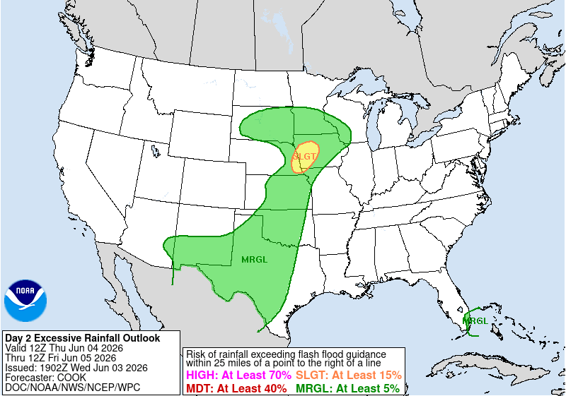
Figure 2. WPC's excessive rainfall outlook
Storms will continue to be an issue on Friday night into early Sunday across the southeast quadrant of the state as a weak frontal boundary makes its way southeast into the central part of the state. The SPC does have much of south central and eastern NE in the slight risk category for severe weather on Friday night into early Saturday. Main risk would be hail and high winds. The front will retreat as a warm front in response to ridging to our southeast, which should allow for a breezy, warm and mostly dry day on Saturday statewide.
Raining on Sunday?
Another upper level low will make its way into the Central Plains by Sunday, which will open chances for rain and thunderstorms across the eastern half of the state down into the Southern Plains on Sunday evening into Monday morning. Severe risk looks rather low at the moment and the heaviest rainfall is likely to be to our east and southeast. An additional systems looks to sneak into the state Monday night into Tuesday, which would open up better chances for moisture into western and central Nebraska.
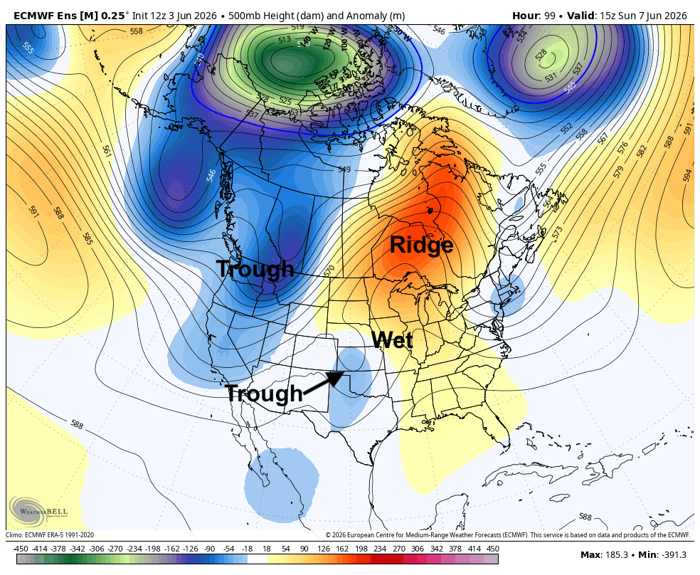
Figure 3. ECMWF ensemble's 500-mb height anomalies on Sunday morning
The heat is on
Ridging will build into the central U.S. during the work week as troughing remains over the Pacific Northwest. By Friday, the center of the ridge should be around Tulsa with a deep trough coming into Saskatchewan and a cold front at the surface starting to come into the Northern Plains. Near the ridge, the heat will get turned up and the winds will also be stronger in response to a tightening pressure gradient. Expect temperatures in the upper 80's to 90's and windy afternoons between Wednesday and Friday/Saturday. Temperatures may crack 100°F across southwestern Nebraska on Thursday and Friday.
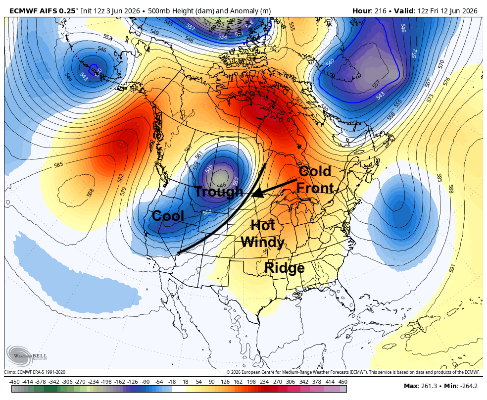
Figure 4. ECMWF AI 500-mb height anomalies next Friday
Rainfed crops in the western half of the state that haven't caught recent moisture and miss out this weekend will certainly be tested. Pastures in the Sand Hills and Panhandle also may be dealt another blow later in the week as well. Storms will be possible as the front enters the state next weekend and temperatures also should cool off to more seasonal and perhaps even seasonally cool levels around the 15th-16th. It will be worth watching to see how far southeast that front gets and if it stalls in the region. As of now the ECMWF ensemble suggests average precipitation in the period from June 10-16th for much of the state but below average for the Panhandle.
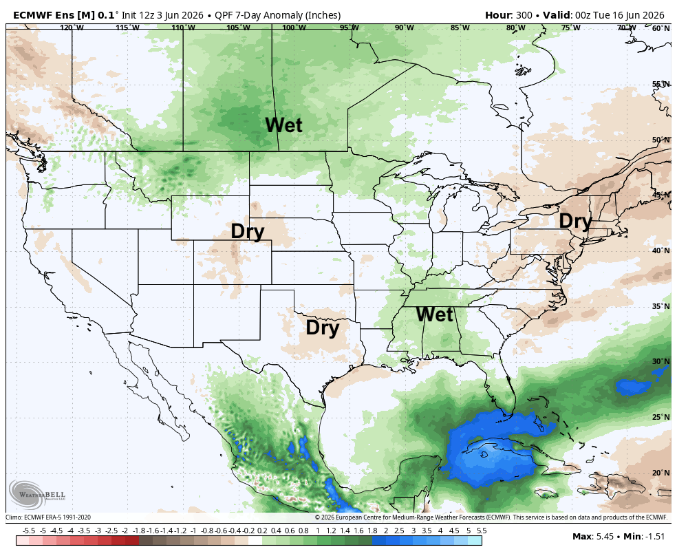
Figure 5. Projected 7-day precipitation anomalies ending June 16th


