
Stormy times ahead
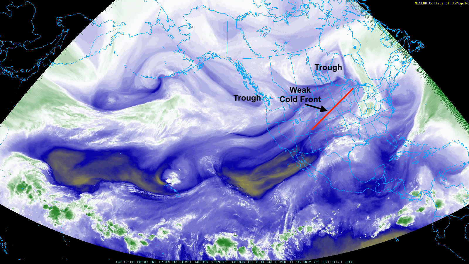
Figure 1. Upper air water vapor analysis from GOES
A look at upper air analysis reveals a deep trough over Manitoba and a SW-NE oriented cold front across Nebraska. Record temperatures in the lower to mid 90's will be common across much of south central and eastern Nebraska this afternoon. The front also will be a focal point for thunderstorm development across the southeast quadrant of the state this evening, with a chance of storms becoming severe.
That front will slide south of the state overnight and will effectively stall to our southeast and will start retreating northward as a warm front on Saturday. This will be in response to the trough entering the northwestern U.S. this afternoon, which will then dive into the Great Basin region before slowly ejecting out into the north central U.S. on Monday.
There will be multiple shortwaves out ahead of the main upper level trough between tomorrow evening and Monday, so showers and thunderstorms (including severe storms with flash flooding potential) will be likely across most of the state Saturday night and Sunday afternoon into Sunday night.
The Storm Prediction Center does have much of central and eastern Nebraska in the enhanced severe weather outlook for Sunday afternoon and Sunday night with wind damage and hail being the main threats. High temperatures will be in the 80's tomorrow with some chance of the 90's returning to central and eastern Nebraska on Sunday. It will also be muggy in eastern Nebraska.
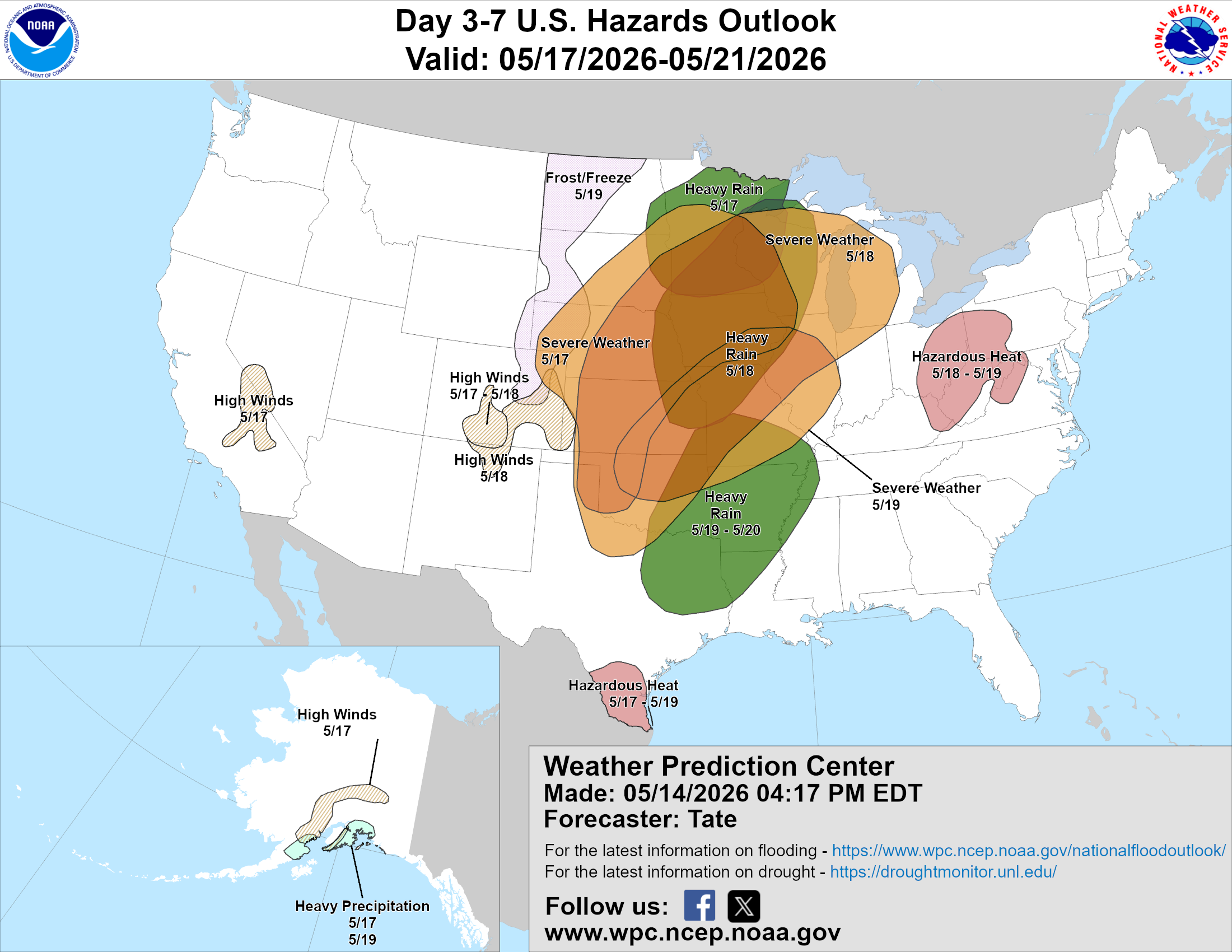
Figure 2 (above; courtesy of NCEP) shows that severe weather is possible at some point this weekend for all but the western Panhandle and heavy/excessive rainfall is possible on Monday.
Stormy Monday?
As the main upper-level trough moves into the north central U.S., a cold front will work its way through the state on Sunday night into Monday. Current projections show it stalling along a SW-NE line from roughly Holdrege to Wayne on Monday and a surface low moving into south central Nebraska. This setup will need to be watched carefully in eastern Nebraska for the possibility of tornadoes and also for heavy rainfall in southeast Nebraska from training thunderstorms. WPC shows the heaviest rainfall occurring over northeast Nebraska but some parts of southeast Nebraska could pick more than the current projections.
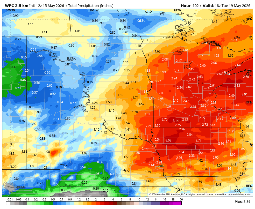
Figure 3. Weather Prediction Center's projection of total precipitation through Tuesday morning.
Cooler temperatures
Temperatures will be much cooler behind the front in western Nebraska on Monday with the Panhandle struggling to get out of the 40's and lower 50's. Those cooler temperatures and drier air will be in place over the whole state on Tuesday. Temperatures should start rebounding back to closer to seasonal levels on Wednesday and Thursday. Additional chances for showers and storms will exist late in the week and into the Memorial Day weekend.


