Chance of storms tomorrow
A weak cold front will be moving through the state tomorrow and this will open chances for showers and thunderstorms between late tomorrow morning and the evening hours. High-resolution models are showing more scattered storms, with the best chance of picking up a quarter inch across south central and southeastern Nebraska. The northeast quadrant of the state is least likely to see any moisture and it's likely precipitation amounts in the south central and southeast sections will be highly variable.

Figure 1. WPC's precipitation projections for tomorrow
Warm week ahead
Ridging will be building across the western U.S. this weekend and start pushing east. This will lead to very warm temperatures in the western U.S. over the weekend and that warmth will make its way into Nebraska by Monday. Highs in the 80's will be likely central and east with lower 90's possible in western sections of the state.
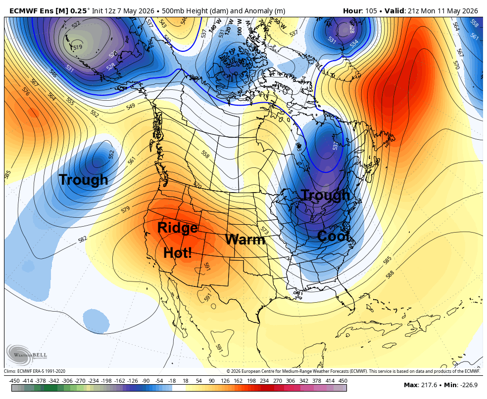
Figure 2. 500-mb height anomalies next Monday
With northwest flow aloft prominent early in the week, we will see a weak front come through Monday evening into early Tuesday. This will open up slight chances for showers and storms in the eastern section of the state Monday night, though no significant precipitation is expected. Temperatures on Tuesday should be a bit cooler in most of the state, though still above average. Seasonally warm and dry conditions are likely to prevail through at least Thursday. Temperatures also may creep back into the mid to upper 80's by late in the week.
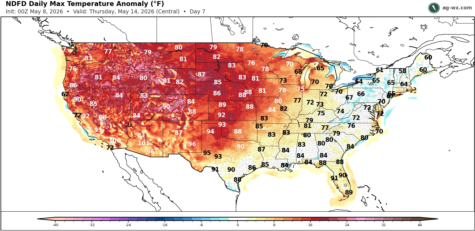
Figure 3. Projected high temperatures on Thursday
Rain/storm chances late week
By late in the week the ridge will have shifted eastward and a shortwave trough may be moving into the High Plains region by Thursday night.
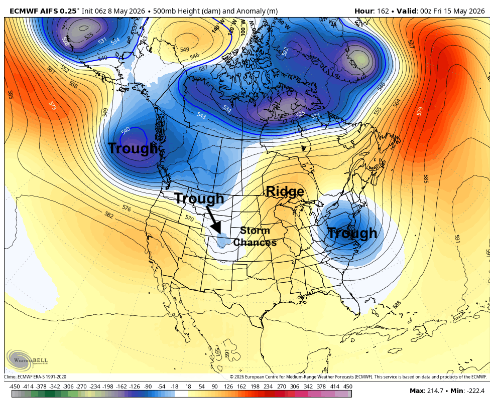
Figure 4. Projected 500-mb height anomalies on Thursday night according to the ECMWF AI model
If that happens (as suggested by some recent ECMWF AI runs), this would help open up an enhanced low level jet in the eastern side of the Plains, which would help bring moisture and instability needed to fuel a round of thunderstorms in the eastern half of the state. Some storms would have the possibility of being severe with hail and heavier downpours. A few ECMWF ensemble members do show a chance of getting over half an inch in the eastern side of the state but there is still a high degree of uncertainty in this forecast.

Figure 5. 925-mb wind speed projections on Thursday night from the ECMWF AI model
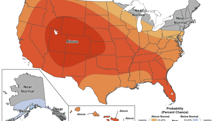
Turning wetter later in May?
The 8-14 day CPC precipitation outlook shows chances for above average precipitation for the southern and eastern portions of the state with no signal elsewhere. There are hints in the long-range models that we may see more troughing getting into the southwest U.S., which would open up more southwest flow aloft and chances for a wetter period coming into the region. This would be great news if that came to fruition for the eastern side of the state where we have been dry of late and absolutely essential for much of central and western Nebraska.
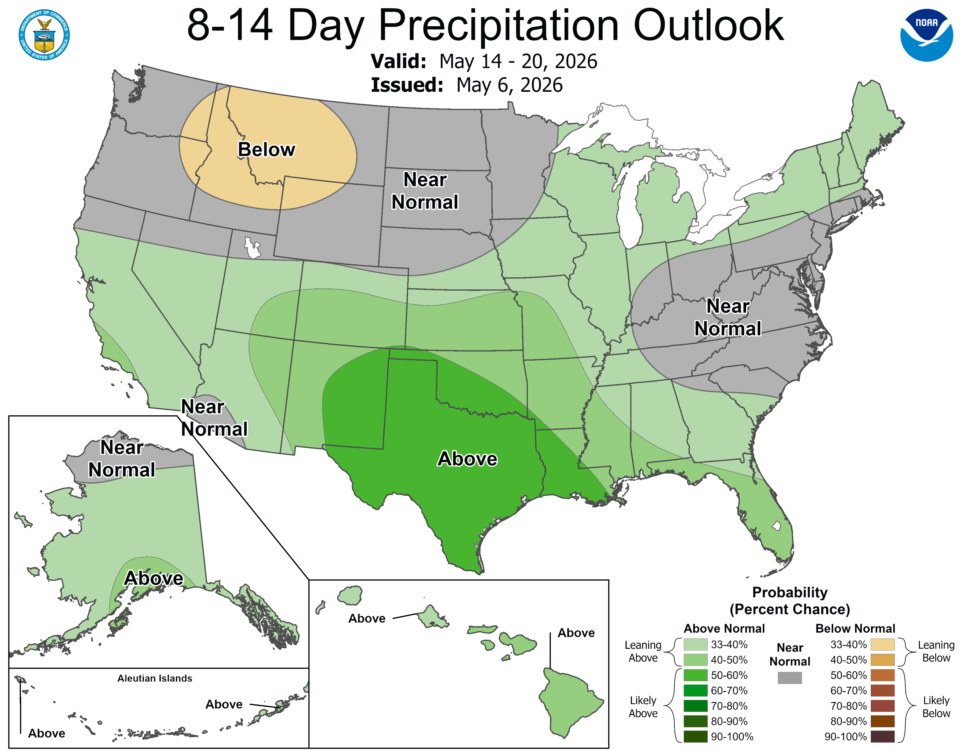
Figure 6. CPC's 8-14 day precipitation outlook


