
Much drier weather ahead
A boat would have been handy for getting around portions of eastern Nebraska last night and flooding near rivers will remain a concern for another few days. But a change is right around the corner and today marks thew beginning of a prolonged stretch of dry weather. For much of central and eastern Nebraska, this is the best news I could possibly give.

Figure 1. Projected 500-mb anomalies next week
Temperatures will be a tad cool to start the week in the eastern half of the state but will warm as upper-level ridging dominates our sensible weather. No rain is in the forecast next week anywhere in the state and our neighbors should also get a nice break.
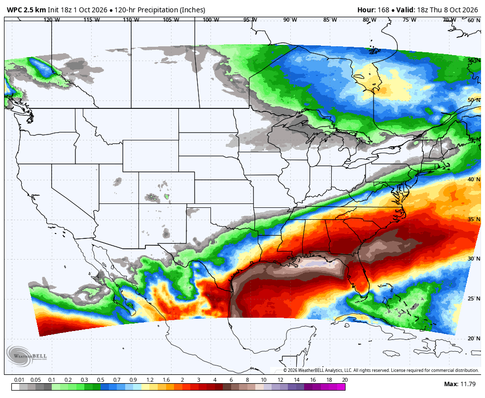
Figure 2. WPC projected precipitation next week
Pardon my dust
The warm, dry weather looks to persist through at least the middle of October and possibly through the latter portion of the month. There will be occasional fronts coming through, including one around the 11th or 12th which could bring a slight chance of rain and a brief cooldown. These frontal passages would bring some breezier conditions but in general, winds are likely to be on the lighter side for much of October. This could lead to dustier conditions in areas adjacent to where harvest is ongoing.


