
Rain chances continue
A look at the upper level water vapor analysis shows a ridge of high pressure over Texas with plenty of monsoonal moisture streaming around it. The same complex of storms that brought highs winds and 2-4" of rain to north central and northeast Nebraska is now moving into Illinois.
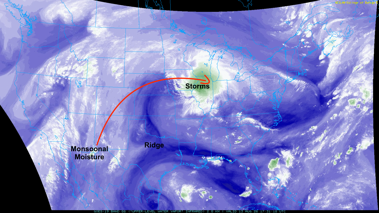
Figure 1. Current upper level water vapor analysis
At the surface a boundary is sitting a little north of Highway 136 with temperatures approaching 90°F south of it and upper 70's to lower 80's north of it. Temperatures are even cooler (mid 60's to low 70's) in the northern Panhandle. Temperatures are already well into the 90's to lower 100's in most of Kansas and Oklahoma.
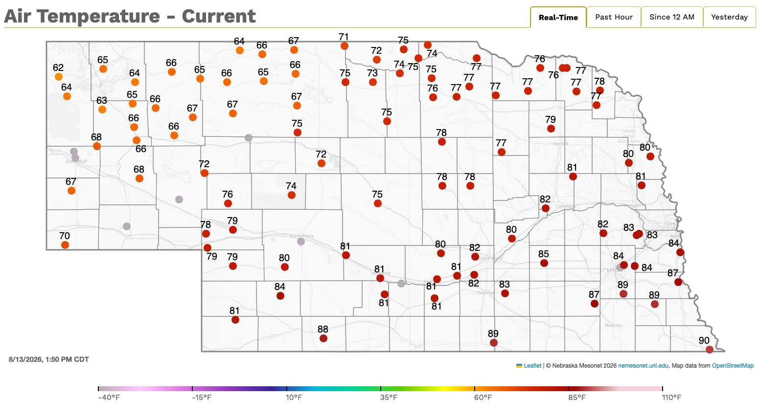
Figure 2. Current air temperatures at Nebraska Mesonet sites
There will be good chances of showers and storms starting later this evening across the western and south-central sections of the state and moving east- northeast into the eastern part of the state overnight. The southeast corner is unlikely to get much but this could be a good rain maker for Holdrege, Kearney, Grand Island, Columbus and Wahoo. There is some chance that heavier rain may be a bit further southeast of where it is currently projected.
Tomorrow and Saturday will feature more of the same with cooler temperatures west and north with sultry conditions in southeast Nebraska. Storms will continue to run along and to the north of the boundary, which isn't going to move much in the next 48 hours. Exactly how much rain will fall is still a little up in the air but it wouldn't surprise me if portions of south central and southeastern Nebraska got substantially more precipitation than what is projected by the WPC on Saturday night into early Sunday.
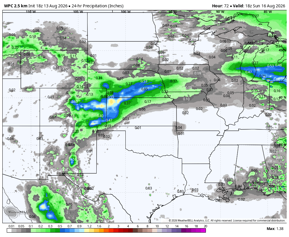
Figure 3. WPC projected precipitation between noon Saturday and noon Sunday.
Cooler temperatures
The boundary will move to our southeast on Sunday so the cooler weather will continue in western Nebraska with a nice break coming to southeast Nebraska. Temperatures on Monday morning should be much more pleasant statewide with lows in the 50's and 60's. Temperatures look to remain pleasant (upper 70's to mid 80's) on Monday, though western Nebraska may be a touch warmer than that.

Figure 4. Projected low temperatures on Monday
Temperatures likely will be at more seasonal levels on Tuesday but another cold front looks poised to move through our region in response to a trough moving into the Great Lakes region.

Figure 5. Projected 500-mb height anomalies next Wednesday morning
Midweek rain chances
This will set up chances for showers and thunderstorms Tuesday night into Wednesday, particularly across the northeast quadrant of the state where rainfall totals over half an inch are most probable. But all of central and eastern Nebraska will likely have some shot at picking up the whole inch. Temperatures will be cooler statewide on Wednesday and may be seasonally cool in eastern Nebraska on Thursday as well. Lows in the lower to mid 50's may be possible.
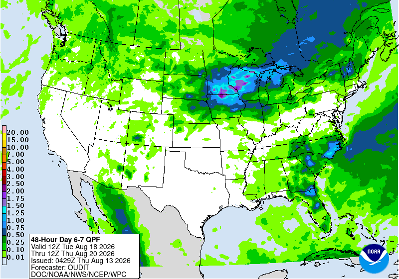
Figure 6. Projected rainfall totals Tuesday night into Wednesday
Warm and possibly wet finish to weekend
The ridge that has been so prominent over Texas of late looks to re-assert itself there again by later in the week. This will keep areas south of I-70 in the oven with no precipitation. Models indicate more shortwaves topping the region with sufficient available atmospheric moisture, though not like we are getting now. This will open up chances for showers and storms to finish out the week.

Figure 7. Projected 500-mb height anomalies by Friday
The projected proximity to the ridge will keep things on the warm side next weekend and seasonally warm/sultry conditions are likely the week after next. There are some hints that the period between August 24-26th could be especially hot statewide. We are past the climatological peak in summer temperatures and days are starting to get noticeably shorter. But late August can still deliver intense heat so I wouldn't bet on being done with it yet.
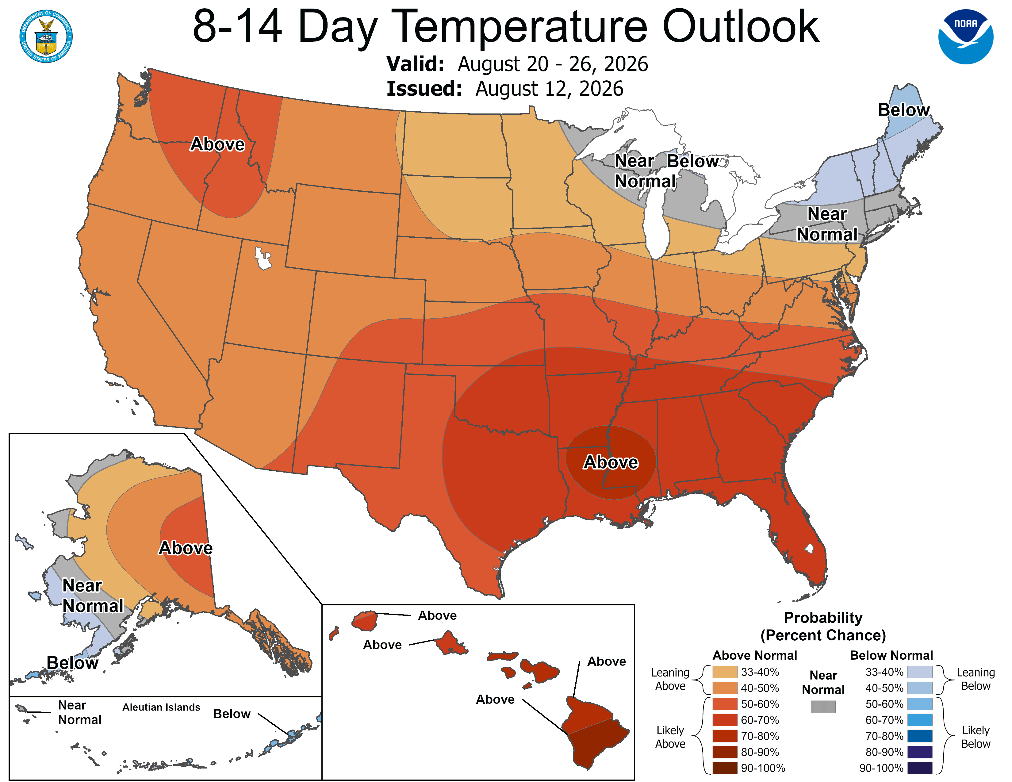
Figure 8. CPC's 8-14 day outlook


