
Cooler temperatures for most
The next 24 hours will bring chances for severe weather and heavy rainfall in the eastern half of the state and a cold front that will bring some much needed relief in the form of reduced humidity and a noticeable breeze from the north. Temperatures tomorrow afternoon will be in the upper 70's to lower 80's in the eastern 2/3 of the state while mid 80's to around 90°F in the Panhandle. Saturday morning will see lows in the 50's and lower 60's, a much needed break from the very warm nights we have had of late.

Figure 1. Projected high temperatures on Saturday, August 1st
Temperatures will remain pleasant in eastern and central and eastern Nebraska (low to mid 80's) but will be quite warm in the Panhandle as they will be in closer proximity to the western upper level ridge. The heat really cranks up in the Panhandle on Sunday with highs possibly cracking 108°F around Chadron. The last thing that area needs is that kind of heat with no rain but such is the way things have gone this year for the Panhandle. Temperatures will cool a bit in western Nebraska on Monday and warm up a bit in the east, but still better than it has been of late.

Figure 2. Projected high temperatures on Sunday, August 2nd
Mid-week storm chances
A trough will move into southern Manitoba and Ontario with a cold front pushing through the Dakotas into Nebraska by late Tuesday into Wednesday. This will bring chances for showers and storms to at least the eastern 2/3 of the state and possibly the entire state. Total amounts projected by the WPC show some potential for over half an inch in central and eastern Nebraska. It is likely most places will pick up some moisture during the middle of the week with some pockets possibly picking up over 2". As has been the case all summer though, some areas will do fairly well and others won't.

Figure 3. Projected 500-mb height anomalies next Tuesday morning
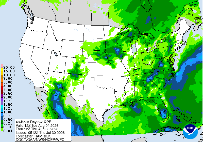
Figure 4. WPC's projected rainfall totals between Tuesday and Thursday
The front should clear the state by early Thursday before washing out in Kansas. Temperatures should drop off in the northern part of the state on Tuesday and Wednesday could feature temperatures holding in the 70's to low 80's if cloud cover and precipitation are prominent.
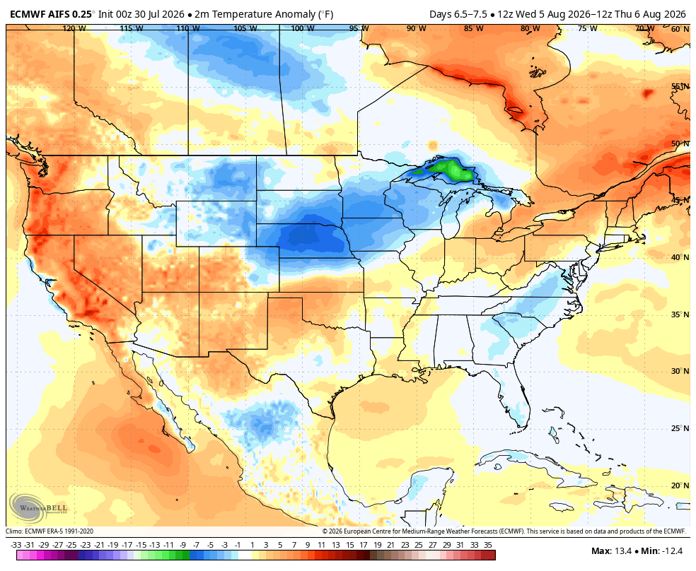
Figure 5. Projected temperature anomalies between Wednesday morning and Thursday morning
Heat coming back
The upper level ridge will likely start building back to the east again later in the week, which will bring the heat back to at least the western half of the state, possibly the entire state. There will be chances for storms at the end of next week in the eastern third of the state and temperatures may remain closer to seasonal levels east of Highway 81. It will likely be in the 90's to lower 100's in western Nebraska and in the lower to mid 90's in central sections of the state.

Figure 6. Projected 500-mb height anomalies next Saturday afternoon
That ridge will likely progress further east next weekend into the week after, which will bring the heat back to the entire Western Corn Belt. Exactly how hot it will be is still to be determined. But highs in the 90's and humidity for south central and eastern sections of the state appear to be a safe bet to start the week after next. The CPC's 8-14 day outlook and the ECMWF ensemble all favor above to well above average temperatures toward the middle of August. If recent history is any guide the period of August 10-12 will be intensely hot and then it will break. Anyone with livestock should prepare for another round of heat. A longer stretch of heat starting next weekend would increase the probability of below trend line corn yields in the state.
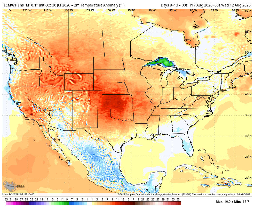
Figure 7. Projected temperature anomalies between August 7th and August 12th according to the ECMWF ensemble.


