Extreme fire risk tomorrow
A strong system will move through the Northern Plains over the next 48 hours and a tight pressure gradient will develop with the deepening low pressure. This means increased wind across the state starting tomorrow morning and it will be particularly windy in western Nebraska. The strong west winds will bring in somewhat cooler temperatures compared to today but will also bring dewpoints down into the single digits. With very low RH values and gusty winds, fire risk will be very high in southwest Nebraska and the southern Panhandle. Blowing dust also will be probable in the western half of the state in fields that are not covered.
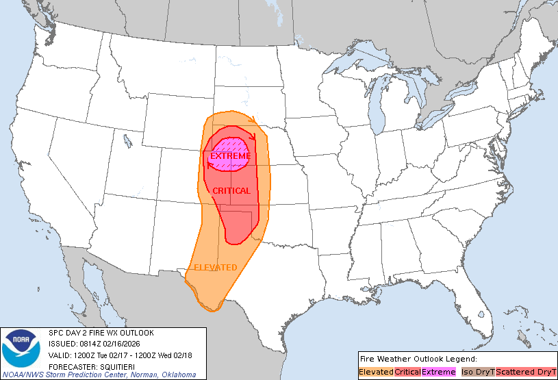
Figure 1. SPC fire weather outlook tomorrow
The SPC currently has an elevated fire risk for the entire western half of the state with critical and extreme fire risk for much of the Panhandle and western Sand Hills. Compounding this is the worsening drought in the western half of the state. The latest U.S. Drought Monitor shows severe drought across most of the Panhandle and extending into Chase and Perkins counties. Extreme drought now covers the Highway 385 corridor from Alliance down into far northern Cheyenne counties. Precipitation, including snowfall, has been almost non-existent this winter in most of the western half of the state. Temperatures have been at or near-record mild this winter and potential ET has been near record levels. Thus, the landscape is devoid of moisture, fuel loads are high, and fire danger risk is critical.
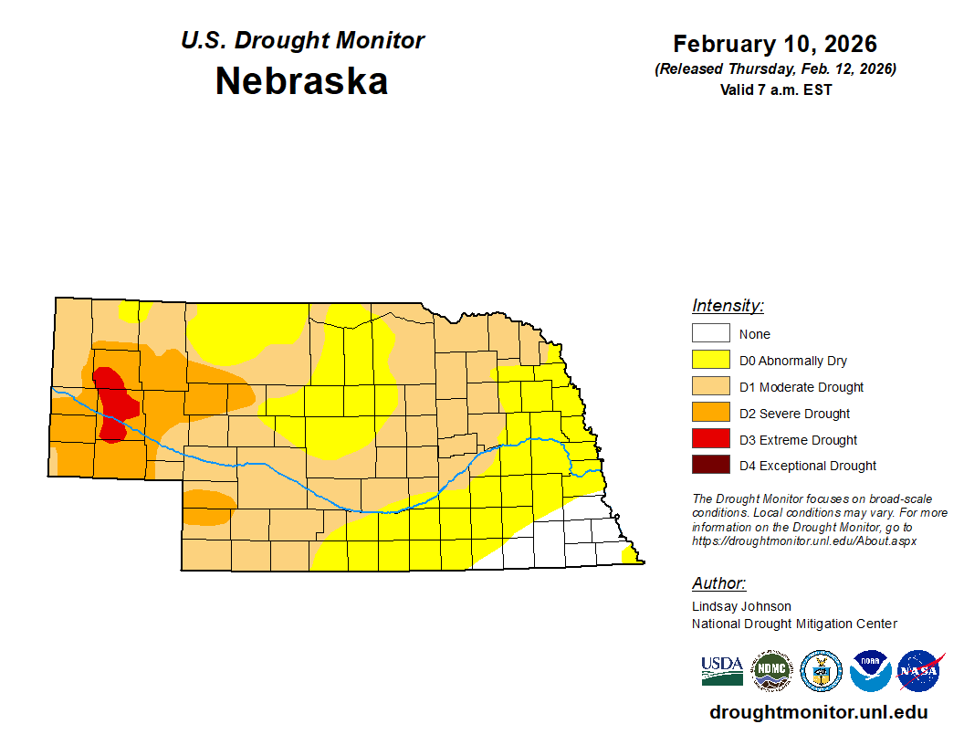
Figure 2. Latest U.S. Drought Monitor
Record temperatures tomorrow
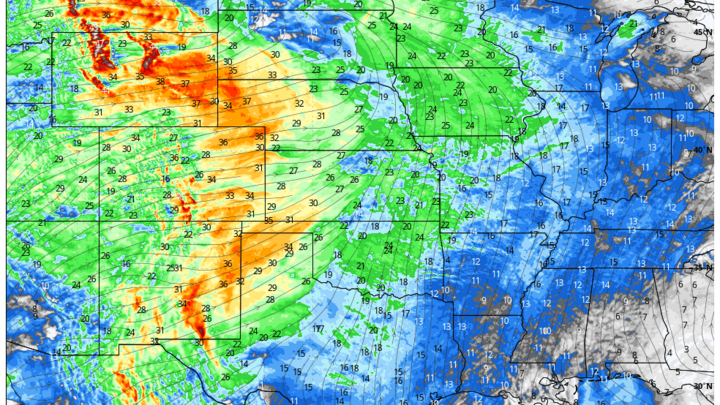
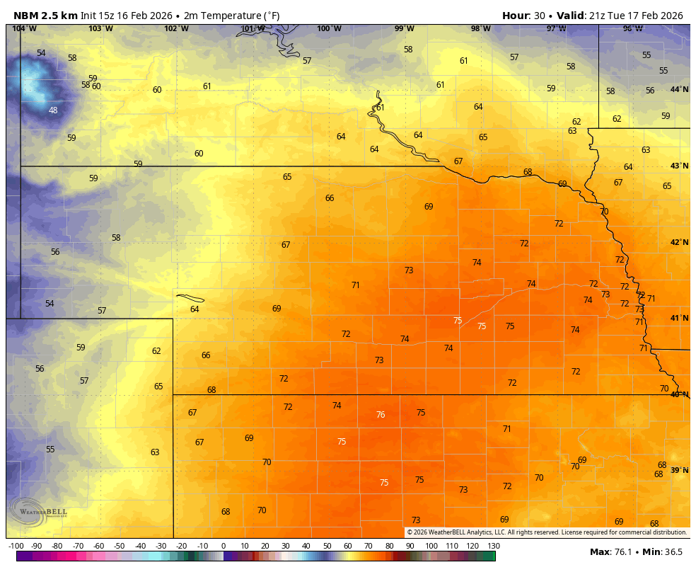
A very warm nose of air will move into south central and eastern Nebraska tomorrow and with optimal mixing, temperatures are going to be at or exceeding record levels from Holdrege into western Iowa. Widepsread temperatures in the 70's are expected in the eastern 2/3 of the state tomorrow afternoon. Temperatures may flirt with 80°F between Clay Center and Central City tomorrow afternoon and likely will exceed 75°F for much of southern and eastern Nebraska east of Highway 183. Record highs are likely in Grand Island, Hastings, and Lincoln and probable in Norfolk and Omaha.
Snow likely
A big change will be coming mid-week as a trough moves out from the Rockies into Kansas. A surface low will develop on Wednesday night in eastern Colorado and likely will move along Highway 36 during the day on Thursday before making a northeast turn once it gets in northern Missouri. There is sufficient cold air on the back side of the system to help produce snow, though precipitation will possibly start as rain in the southeast part of the state.
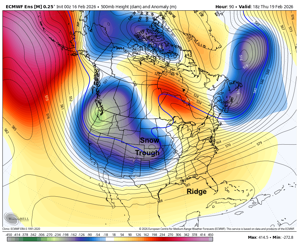
Figure 3. Projected 500-mb height anomalies on Thursday
The exact track of the system is still a little in question but confidence is increasing that much of the state will receive accumulating snow between Thursday and Friday morning. The 00Z ECMWF ensemble shows a good chance at 3"+ for the Highway 20 corridor with a slight chance at snowfall totals of 6-10". The current projected track would put the I-80 corridor south of the best snowfall totals but a slight southward track of the storm system would put that 3-6" area closer to Omaha, Lincoln, and Grand Island. Winds will also be gusty from the north-northwest by Thursday afternoon so visibility may be quite poor in rural areas, especially along east-west roads.
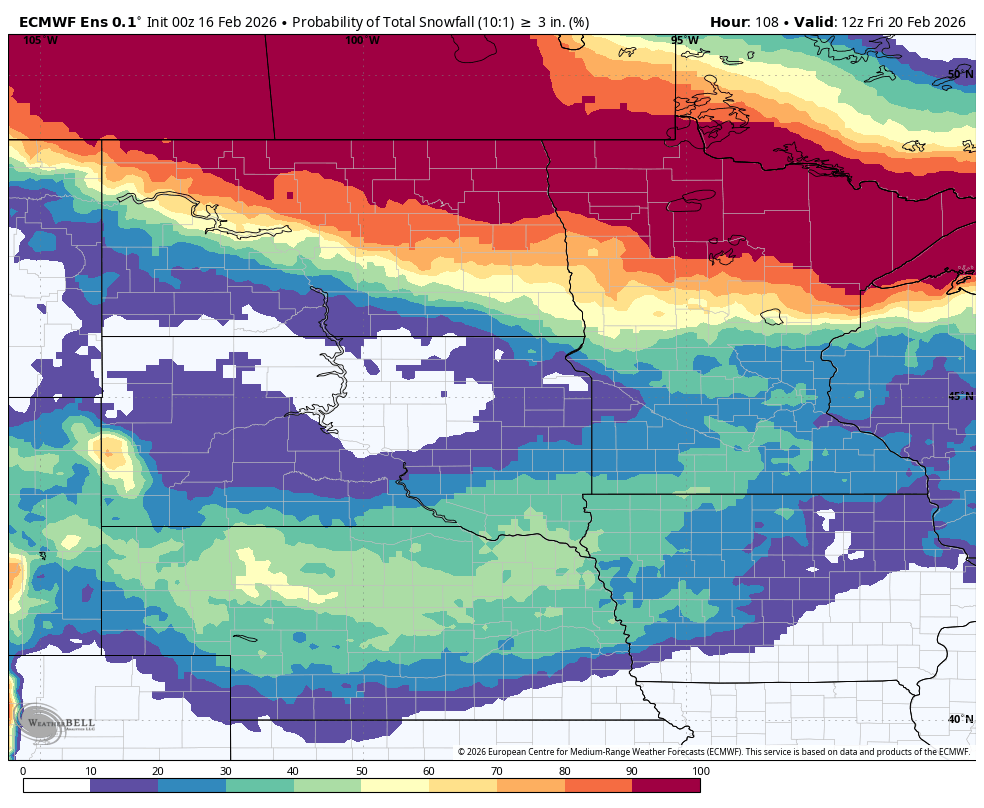
Figure 4. Probability of 3" of snow between Thursday and Friday morning
Precipitation could possibly start as rain in southeast Nebraska on Thursday as temperatures may not support snow until late in the afternoon or evening hours. Regardless, temperatures will be much colder Thursday statewide and temperatures likely will remain below freezing in the northern and western sections of the state. Subfreezing highs will be probable across much of central and eastern NE on Friday. Another system may be moving close enough to our area to deliver more snow on Saturday and temperatures are likely to remain on the cold side through the weekend.