
Rain chances tonight and tomorrow
A current look at upper air analysis shows a deep trough (Trough 1) coming into the northern Rockies with zonal flow across most of the southern two-thirds of the U.S. Another trough off the coast of California coming underneath a ridge of high pressure is starting to move east. Both will have impacts on our sensible weather over the coming days, with proximity to Trough 1 helping keep the western half of the state on the cool side in the next few days.
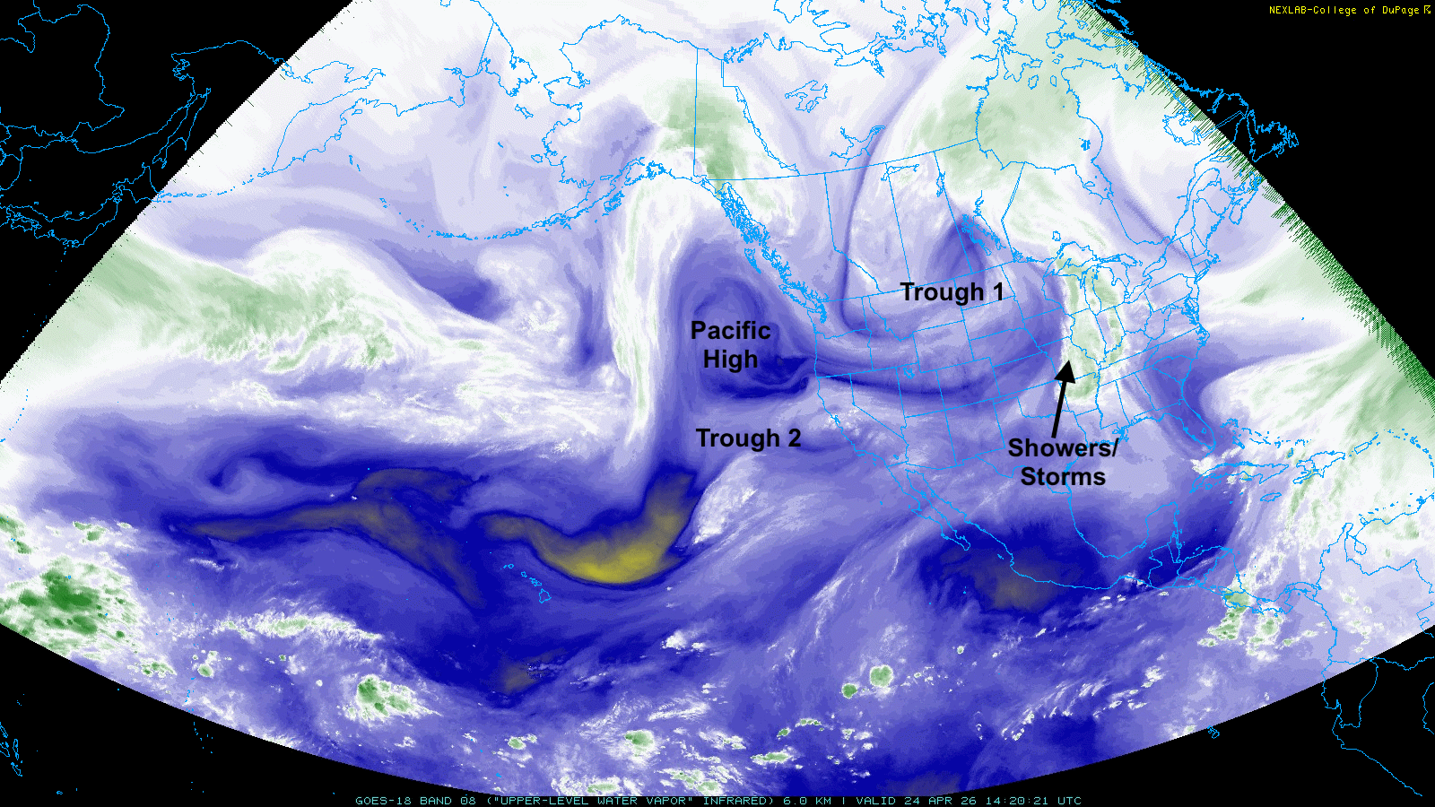
Figure 1. Upper air analysis via the upper level water vapor channel from GOES.
A modest shortwave will move through the Northern Plains around Trough 1 over the next 24 hours, which will help bring chances for rain later this afternoon and tonight in the northern third to half of the state. Areas between Valentine and Ainsworth could pick up over a quarter inch. This shortwave will help bring the cold front that went through yesterday back to the north as a warm front into the eastern part of the state, which will open chances for showers and thunderstorms in south central and eastern Nebraska tomorrow afternoon and evening. Figure 2 shows the HRRR depiction of showers/storms tomorrow at 5 PM Central.
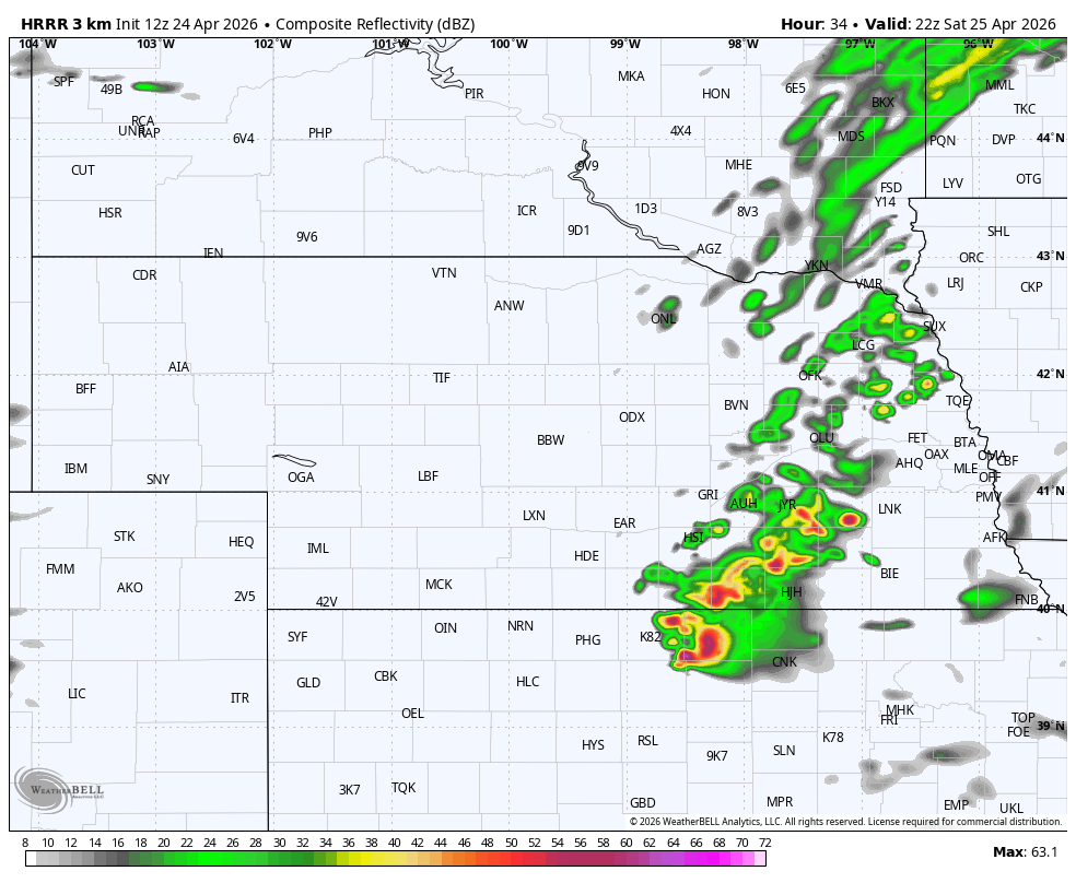
Figure 2. NOAA HRRR depiction of showers/storms tomorrow (Saturday) at 5 PM Central.
The SPC does not have any of the state in the severe storm risk tomorrow but storms with heavy rain rates and small hail will be possible, especially in southeast Nebraska. Temperatures also will be much cooler (40's to mid 50's) in central and western Nebraska tomorrow, which will be socked in with clouds and winds from the north. The eastern section will have winds from the south-southeast and temperatures in the mid 60's to lower 70's before the rain/storms.
Storms Sunday into Monday morning
A more potent shortwave will move out into the central U.S. on Sunday and a surface low will develop and move from eastern Colorado into Kansas. This will provide easterly, upslope flow and chances for rain in western Nebraska starting Sunday morning. As the surface low moves northeast, showers and storms will move east and east-northeast into the eastern half of the state on Sunday afternoon into the early evening hours.
An additional round of storms are expected to develop along the cold front across central and eastern Nebraska on Sunday night and move east through Monday morning. Severe storms will be possible Sunday afternoon and Sunday night in south central and eastern Nebraska. The SPC currently has this region in the slight risk but it may be possible that this area gets upgraded to an enhanced risk. Large hail, high winds, and flash flooding would be the biggest risks but tornadoes may also be possible. Precipitation totals over an inch are likely across much of north central and eastern Nebraska. Precipitation amounts between a half inch and three quarters of an inch are more likely in western and south central Nebraska. This won't come close to ending the drought but it would be the best moisture most of that area has seen in months and will be critical for pastures and the winter wheat crop.
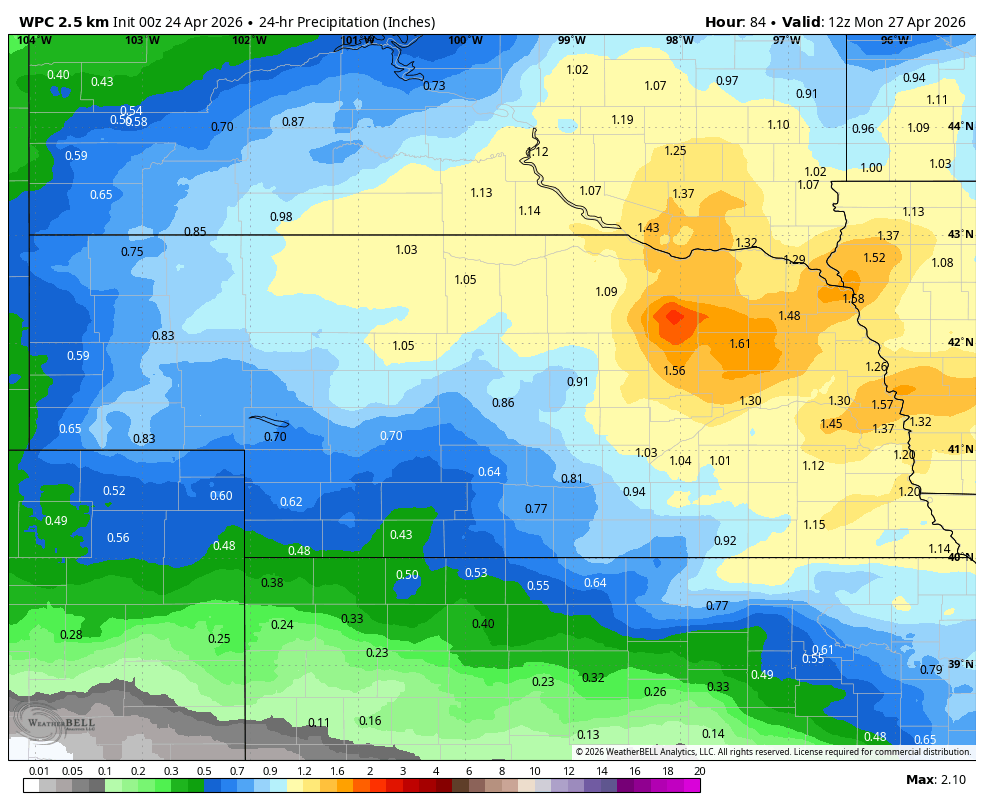
Figure 3. WPC 24-hour precipitation projections between Sunday morning and Monday morning.
Cool temperatures prevail next week
Temperatures will be on the cool side on Monday and Tuesday across the state. Highs may struggle to get out of the 40's in the northern Panhandle and Sand Hills on Monday and temperatures in the 50's will be common everywhere on Monday afternoon with gusty winds from the north. Temperatures will be slightly warmer the other days of the week but still relatively cool for this time of year as troughing over the north central region of the U.S. remains prominent for much of the week. Temperatures will be coldest relative to average across the northern Panhandle.

Figure 4. Projected temperature anomalies next week
Mid-week moisture chances
Another trough will move from the southwest into the central U.S. later in the week, which will bring chances for showers to the region. It looks like this system will track further south but rain is possible on Wednesday into Thursday, particularly across the southern half of the state. If it ends up being further north, this could give much of the state a good shot of moisture. The next week will not end the drought that continues to get worse in much of the western half of the state, but it may be the first step toward some relief and recovery.
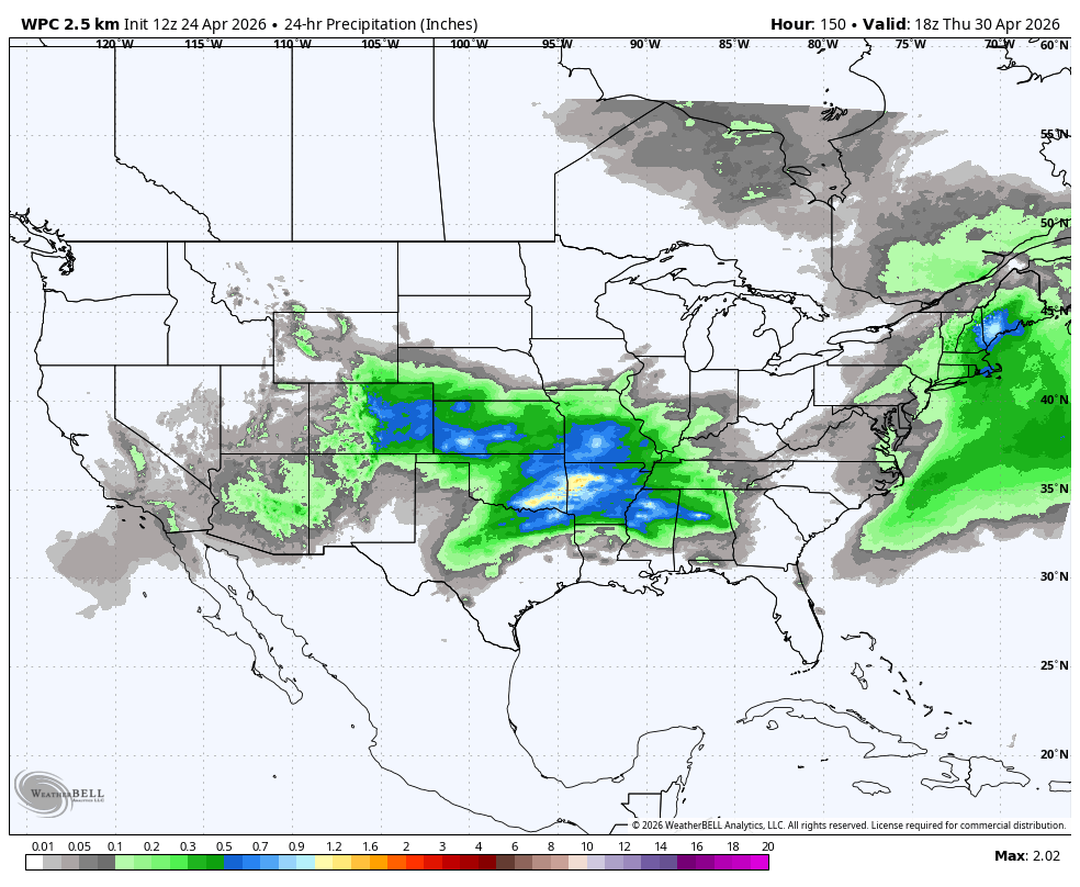
Figure 5. WPC 24 hour projections of precipitation through midday Thursday.


